

























































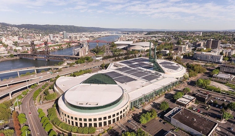
At a national earthquake engineering conference in Portland on Thursday, regional specialists pulled no punches: the Pacific Northwest is still underfunded and loosely coordinated for the Cascadia “Big One,” and critical lifelines could be out for months if it hits. Highways, water mains, fuel lines, ports and airport runways, they warned, are all at real risk of being severed, leaving both coastal and inland communities cut off. Engineers pointed to recent retrofits and new projects as proof that fixes are possible, but pressed for a faster, more unified push to copy those efforts across the region.
As reported by OPB, those warnings came during the 13th U.S. National Conference on Earthquake Engineering in Portland, where seismologists, engineers and emergency managers laid out what is still missing in plans to keep transportation, water and fuel corridors working after a major Cascadia rupture.
Critical Corridors at Risk
Speakers hammered home that a handful of routes and crossings are chokepoints for recovery; if coastal U.S. Route 101 or key river bridges fail, they said, entire communities could be stranded for months. That assessment, and a tally of vulnerable bridges and routes, has been detailed in regional work that singles out both fragile coastal highway segments and dozens of state bridges as top retrofit priorities. Mike Olsen, director of the Cascadia Lifelines Program at Oregon State University, has been leading efforts to map those weak spots and set retrofit priorities. The Cascadia Lifelines Program lays out the technical basis behind those conclusions.
Panelists also pointed to water and power links as concrete examples of where the region needs to spend now rather than later. The Willamette Water Supply Program, a roughly $1.6 billion effort to add an alternate water source for parts of Washington County that includes a long microtunnel under the Tualatin River and related road work, was held up as a case study for the scale and cost of resilience projects. Materials from the Willamette Water Supply Program describe the new pipeline and the corridor upgrades planners say will be essential for post‑quake access.
Race to Retrofit State Assets
On the state side, officials and engineers argued that policy changes are in motion but still need sustained funding and tight oversight. Gov. Tina Kotek has signed an executive order that directs agencies to ensure new state buildings over 10,000 square feet meet tougher seismic standards and that existing state facilities are retrofitted in phases by 2060, with the goal of keeping critical offices usable after a major quake. That statewide push follows a multiyear, high‑cost seismic retrofit of the Oregon State Capitol, which is now frequently cited as proof that large, complex projects can be brought up to modern standards. The order and related materials from the Office of the Governor spell out the directive and track recent work on state buildings.
Funding Math and the Ask
Conference participants also tried to translate all of this into budget language that lawmakers and the public might actually act on. Port and airport engineers described multimillion‑dollar upgrades they say are needed so facilities can receive relief and move supplies after a catastrophic quake, with one session citing a Port of Portland assessment that pegs some runway and terminal work in the hundreds of millions of dollars. The Oregon Capital Chronicle reported those figures and the related budget debates.
Planners at the conference repeatedly pointed to national benefit‑cost studies that argue modest, targeted mitigation pays off over time. The National Institute of Building Sciences’ Natural Hazard Mitigation Saves analysis finds that modern seismic codes and other mitigation investments can produce large net savings over the life of a building or infrastructure project. The National Institute of Building Sciences provides the underlying benefit‑cost data.
Science to Policy: Centers Pushing Coordination
Researchers stressed that the region already has tools, and new centers, that can turn science into action if money and clear governance follow. Multi‑institution efforts such as the Cascadia Region Earthquake Science Center and university lifelines programs are focused on translating hazard science into usable products like maps, retrofit priority lists and routing plans for emergency managers.
Conference organizers cast the week as a chance to move those research products into real regional planning and to press state and federal partners to treat lifelines as a top policy priority. The 13NCEE (EERI) materials and regional center publications outline the research‑to‑policy pathway they are promoting.
Officials at the conference framed the decision in blunt terms: either accelerate coordinated investment now, or brace for far higher costs and a slower recovery later. Technical reports from ODOT and others that map where bridges, slopes and utilities are most vulnerable have been public for years, and the argument in Portland was that the missing piece is long‑term funding and an interagency mechanism to turn those vulnerability maps into actual retrofits. The Seismic PLUS report from ODOT is among the core studies speakers said should guide that work.





.jpg)