Thunderstorms muscled through Cherokee County on Thursday evening, firing off strong wind, heavy rain and hail as a fast-changing line of storms swept across the mountains. A National Weather Service warning urged people in communities including Murphy and Culberson to hunker down, stay tuned to emergency alerts and wait it out indoors.
Official warning and timing
According to NWS Morristown, forecasters issued a severe thunderstorm warning at 6:05 p.m. Thursday after spotting a storm over Murphy moving west at roughly 15 mph. The warning flagged wind gusts up to 60 mph, strong enough to damage roofs, siding and trees, along with torrential rain that could trigger flash flooding. The alert was set to expire at 6:45 p.m., although officials cautioned that the situation could shift as the storm line evolved.
Impacts and where to expect trouble
As reported by The News & Observer, the warning specifically called out Murphy and Culberson and noted the potential for hail up to about 0.75 inches, roughly the size of a penny, along with damaging winds. Radar snapshots and emergency feeds showed a compact but intense cell that forecasters said could snap small limbs and send unsecured outdoor items tumbling. Local emergency-management pages and weather aggregators pushed out frequent updates as the storms slid west.
How to stay safe
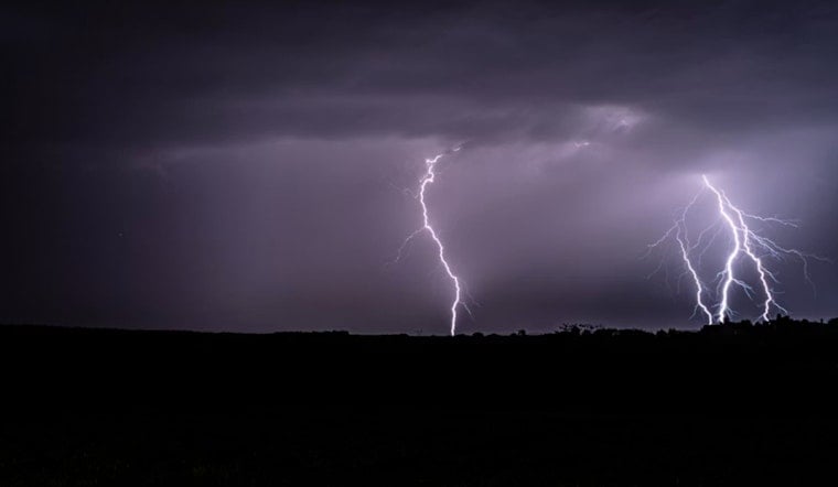
Authorities urged residents to move to an interior room on the lowest floor, steer clear of windows and avoid driving through flooded roads, since heavy rain can cause fast, localized flooding. The storms also carried lightning, which remains one of the most underestimated hazards during severe weather. The National Weather Service estimates the United States sees roughly 20 to 25 million lightning flashes each year and about 20 lightning-related deaths annually, and it recommends waiting 30 minutes after the last rumble of thunder before heading back outside. For full guidance on lightning safety, see NWS lightning guidance.
Local coverage and what to watch next
Hoodline published an earlier rundown that put gusts closer to 50 mph and hail around half an inch as the storms passed through, see 50 Mph Gusts, Half‑Inch Hail. Residents in Cherokee County are urged to keep monitoring the NWS office, county emergency pages and local broadcasters for any new warnings or damage reports. Anyone encountering downed power lines or blocked roads is advised to report them to local authorities rather than trying to approach or move debris.


