

























































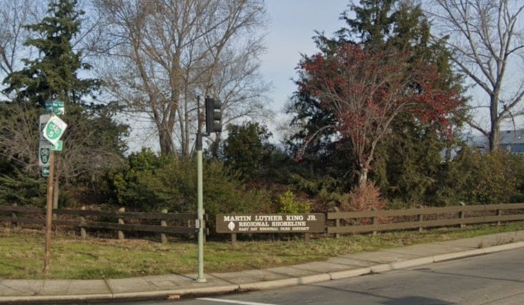
Martin Luther King Jr. Regional Shoreline sits less than a mile from San Leandro Street in East Oakland, but reaching its 748 acres of marshland and bird habitat on foot means crossing three sets of train tracks, dodging freeway interchange ramps, and navigating a narrow, dangerous sidewalk on the 66th Avenue bridge. For most nearby residents, the park is effectively reachable only by car.
Now the Oakland Department of Transportation is preparing a design update meant to change that, according to The Oaklandside. The plan calls for a shared-use path on the south side of 66th Avenue running from San Leandro Street to Oakport Street, new signal crossings, and the removal of one or two southbound driving lanes to make room for people walking and biking. OakDOT also intends to remove the southbound freeway ramp at the end of 66th Avenue and widen the pedestrian and vehicle bridge that currently forces walkers onto a cramped sidewalk.
A Park Many East Oakland Residents Don't Even Know Exists
The scale of the disconnect is stark: studies cited in the Martin Luther King Jr. Shoreline Access Study found that a third of Deep East Oakland survey respondents did not know the park existed at all, and researchers concluded the shoreline lacks meaningful pedestrian or bike access. Garretson Point staging area is the only shoreline entrance near a BART stop, yet local transit agencies have failed to establish a dedicated bus stop serving low-income residents living within a few miles of the park, per the same study.
People without cars trying to reach the shoreline typically face a narrow, dangerous sidewalk on the 66th Avenue bridge or fast-moving traffic along Oakport Street, and those approaching from San Leandro Street must cross three sets of train tracks, including active ones. AC Transit lines 1, 40, and 73 run nearby, but OakDOT is now proposing two new AC Transit bus stops at a park trailhead to close that gap. Survey respondents also indicated that free transportation would increase their interest in visiting the shoreline, the outlet reported.
Funding Secured for Design, Not for Construction
Regional and state funders have already provided $3.3 million to OakDOT for the road-change design work, drawn from the Alameda County Transportation Commission's Measure BB funds and a California State Coastal Conservancy grant, according to the City of Oakland. But the project has no secured construction funding, and the estimated construction cost runs between $12 million and $15 million. OakDOT expects to sign an engineering and design consultant in February, with construction potentially not beginning until 2030.
Jane Mei, cited in the Oaklandside report, said closing the freeway ramp requires extensive coordination and review from Caltrans, and that the existing pedestrian crossing near the park — which relies on a push-button and flashing yellow light — does not reliably stop cars. OakDOT will need to coordinate with both Union Pacific Railroad, which controls the active rail crossings, and Caltrans, which oversees the Interstate 880 ramps slated for removal. Project design and coordination are expected to take several years.
Robert Prinz urged OakDOT to implement interim traffic-slowing and pedestrian and bike improvements on 66th Avenue in the meantime, rather than waiting for the full build-out. He noted that a planned 2028 paving project could offer an opportunity to pilot some of those infrastructure changes ahead of full construction.
Years of Community Advocacy Behind the Project
The push for better shoreline access isn't new. The East Oakland Neighborhoods Initiative identified the 66th Avenue BART to Bay Trail project as a top community priority back in 2021, and the project gained momentum that same year. The 2022 East Oakland Mobility Action Plan later designated it the highest-priority mobility initiative among 21 local projects slated for advancement in its five-year plan, according to the City of Oakland.
The shoreline itself carries deep civic history. Originally opened in 1980 as San Leandro Bay Regional Shoreline, the park was unanimously renamed in 1992 by the East Bay Regional Park District board to honor Dr. Martin Luther King Jr., following requests from local civic and religious leaders. Its ecological value runs just as deep — a 1986 lawsuit filed by the Golden Gate Bird Alliance against the Port of Oakland over proposed wetland destruction led to a decade of litigation that ultimately produced a settlement establishing a 72-acre restored wetland complex now protected within the park, according to the Golden Gate Bird Alliance.
Habitat for Rare Birds, and a Bigger Trail Network
Within the shoreline, the 50-acre Arrowhead Marsh provides critical habitat for the federally endangered California Ridgway's rail, a secretive bird species found almost exclusively in San Francisco Bay salt marshes, the Golden Gate Bird Alliance notes. The park also hosts snowy egrets, great blue herons, sandpipers, terns, and grebes. It connects to the Garretson Point Trail, which links to the El Cerrito Creek Trail, Arrowhead Marsh Pier, and Doolittle Bay Trail, the latter situated next to Oakland Airport.
The shoreline holds roughly five miles of the San Francisco Bay Trail, a planned continuous 500-mile loop encircling the Bay Area across 47 cities, of which more than 350 miles are already completed, according to data compiled by Komoot. Gap closures like this one have precedent in the area — in October 2004, the East Bay Regional Park District retrofitted an abandoned railroad bridge at Damon Slough, linking northern trail sections directly to Arrowhead Marsh, per the Metropolitan Transportation Commission.
Redevelopment Next Door Raises the Stakes
The 66th Avenue corridor directly borders the Oakland Coliseum complex, near Coliseum BART on San Leandro Street, where the City of Oakland agreed in 2024 to sell its 50 percent ownership stake to the African American Sports and Entertainment Group for $105 million to enable major multi-use redevelopment. That looming transformation could significantly increase foot traffic and neighborhood density along 66th Avenue in the years ahead, adding urgency to the push for safer walking and biking infrastructure.
Advocates also point to broader climate benefits from shifting trips away from cars. Research from the Rails to Trails Conservancy shows that bicycle and pedestrian travel along regional trail networks generates carbon emissions more than 25 times lower than those of passenger vehicles, helping reduce overall vehicle miles traveled in urban corridors. For now, though, the vision for a safer route between East Oakland and its shoreline remains largely on paper — funded for design, but still years from breaking ground.



