

























































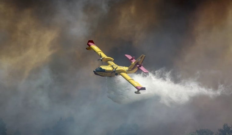
A wildfire has burned 10 acres of private land in eastern Alameda County after igniting shortly after 1 PM today near the junction of Interstate 580 and Interstate 205 close to the Altamont Pass. The blaze, dubbed the Grant Fire, was first spotted at 1:03 PM, and as of the latest information, its containment status and cause remain determined.
According to the Sacramento Bee, the fire is being tracked through the National Interagency Fire Center, which is currently the source for updates on the incident. The area sits along a stretch of freeway that, as reported by SFGATE, pinpoints the fire near two major regional freeway interchanges that link the Bay Area to the Central Valley. No injuries or structural damage have been reported in connection with the 10-acre fire.
Same Name, Different Fire — Again
This is not the first time this year that a blaze called the Grant Fire has broken out along this exact corridor. Just 16 days earlier, on August 15, another fire, also named the Grant Fire, burned 21 acres near I-580 and Grant Line Road before CAL FIRE crews fully contained it in about five hours, according to Patch. The same publication notes that CAL FIRE routinely names wildland fires after nearby landmarks or road intersections, which means multiple distinct fires can end up sharing an identical name.
Patch's reporting lists at least four separate ignitions carrying the Grant Fire name so far this year: one on June 14, another on August 8, one on August 15, and now today's. The June 14 fire burned 21 to 22 acres in the same stretch between Livermore and Tracy, and a 1.5-acre brush fire also called the Grant Fire was logged near I-580 and Mountain House Parkway on August 8 by Watch Duty, which tracks wildland fire radio dispatches and satellite data in real time. That repetition can make it tricky for anyone searching online records to tell the incidents apart.
Why This Stretch Of Freeway Keeps Catching Fire
Eastern Alameda County's Altamont Pass corridor is notoriously fire-prone. An Alameda County environmental hazards report found that the area's steep terrain, dry annual grass fuel loads, and strong pass winds — the same currents that power the region's famous wind turbines — create high fire hazards for crews working the corridor. Wildland fire protection in the county's State Responsibility Area falls to CAL FIRE's Santa Clara Unit, which maintains mutual aid agreements with the Alameda County Fire Department, per a CAL FIRE statement.
Even small roadside ignitions in this stretch can cause outsized disruption. Grass fires along the Interstate 580 corridor near Grant Line Road routinely force the California Highway Patrol to close travel lanes or entire freeway sections, according to SFBay, severing a route that carries tens of thousands of daily commuters between San Joaquin County and the East Bay.
A Reminder Of How Fast These Fires Can Grow
The danger isn't hypothetical. In June 2024, the wind-driven Corral Fire erupted just southeast of the Grant Line Road corridor near Tracy and swelled to 14,168 acres, injuring two Alameda County firefighters and forcing major closures on Interstate 580, as reported by CBS News. It remains one of the largest early-season wildfires Northern California saw that year.
State wildfire tracking data shows that, prior to Monday's ignition, 11 wildfires had already burned a combined 1,241 acres across Alameda County during the 2026 fire season, with the largest being the 1,007-acre Little Fire in July. CAL FIRE guidelines also require property owners within State Responsibility Areas to maintain 100 feet of defensible space around structures under California Public Resources Code Section 4291, a measure meant to protect rural homes and agricultural outbuildings from fast-moving grass fires like this one.
Monday's Grant Fire adds to a busy summer of wildland fire activity across the county. Hoodline previously covered the Vargas Fire in Fremont's hills in July and a suspected arson fire at Garin Park in Hayward earlier in August. As of the latest available information, the cause of Monday's Grant Fire has not been determined, and containment figures had not yet been released.





