

























































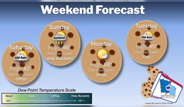
Minneapolis is starting Saturday with light rain, fog and temperatures near 68 degrees, with the wettest stretch of the morning still ahead. Showers and thunderstorms are likely through late morning before clouds linger and the day warms toward 82.
Rain Eases Before Saturday Afternoon
Rain chances will remain highest through the morning, with rainfall totals generally between a quarter and half an inch. According to the NWS Twin Cities/Chanhassen, most of the rain should clear Minneapolis around 10 a.m., while areas farther east may stay wet closer to noon.
Thunder is possible during the morning, with south to southeast winds around 5 to 10 mph and stronger gusts possible in storms. No watches, warnings or advisories are listed for the forecast area, but the soggy start could complicate early errands, outdoor events and Saturday travel.
The timing is now arriving in real time rather than remaining a late-night possibility. Hoodline's earlier forecast flagged the overnight-to-morning shift, while the latest update puts the main washout squarely in the first half of Saturday.
Sunday Brings Back The Heat
Once Saturday's rain exits, the pattern turns warmer quickly. Sunday should be partly sunny with a high near 87 and only a slight chance of rain, followed by a mostly sunny Monday near 88.
Sunday and Monday are also expected to feel humid, with warm overnight lows in the upper 60s to low 70s. That means Minneapolis gets a brief rainy reset before summer temperatures return with very little interest in leaving.
Warm 80s Continue Into Next Week
Tuesday should reach about 85 degrees, with a slight chance of morning showers and a better chance for showers or thunderstorms Tuesday night. Wednesday could start with a few storms before turning mostly sunny, again near 85.
Thursday and Friday stay in the mid-80s, with only low chances for additional showers and thunderstorms. The local forecast points to a warm week ahead, but not a complete washout.





