

























































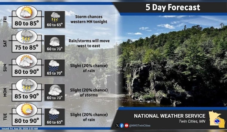
Minneapolis is waking Friday, August 28, to clear skies, calm winds and temperatures around 61 degrees, with a sunny climb toward 85. The quiet start will not last all weekend: rain and thunderstorms are most likely late Friday night into Saturday morning.
Sunny Friday, Then Clouds Move In
Most of Friday should stay dry and sunny, with a high near 85 and light south-southwest winds of 0 to 5 mph. Some patchy fog may develop early in low-lying spots or near bodies of water, but the National Weather Service Twin Cities says it should lift quickly after sunrise and widespread dense fog is not expected.
Clouds will gradually increase Friday afternoon before a 30% chance of showers and thunderstorms arrives late Friday night, especially toward early Saturday. The timing is a notable shift from Hoodline's earlier forecast, with the wet weather now more clearly focused on the overnight and Saturday morning period.
Saturday Morning Looks Wet And Breezy
Showers and thunderstorms are likely before noon Saturday, August 29, followed by only a slight chance of additional rain through about 1 p.m. The high should reach 81 degrees, with south-southeast winds of 10 to 15 mph and new rainfall totals generally between a tenth and a quarter of an inch.
Strong or severe storms are not expected to be the main story, with the weather service describing that risk as low. No watches, warnings or advisories are currently posted for the area, but outdoor plans could still run into a soggy Saturday morning.
More 80-Degree Days Next Week
Sunday, August 30, could bring a morning shower or two before partly sunny skies and a high near 87. Monday, August 31, stays warm near 87 with a slight storm chance, while Tuesday, September 1, looks mostly sunny near 85.
The warm pattern continues Wednesday, September 2, and Thursday, September 3, with highs in the mid-to-upper 80s and only low chances for showers or thunderstorms. Summer, apparently, has decided it is not ready to pack up just yet.





