

























































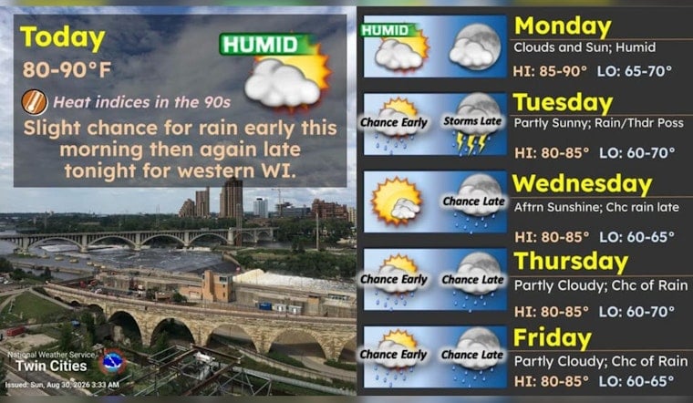
Minneapolis is starting Sunday clear and near 70 degrees, but the day will quickly turn hot, humid and partly sunny. A brief shower chance arrives this morning before temperatures climb to about 88 degrees, setting up another warm stretch across the city.
Morning Showers Give Way To Muggy Sun
A slight chance of rain showers is expected between 7 and 10 a.m., with east winds around 5 to 10 mph. After that, skies should brighten, while humidity pushes heat index values to around 90, according to the National Weather Service Twin Cities.
Sunday night will stay mostly cloudy with a low near 72 degrees. The updated timing is a notable change from the earlier outlook, which had focused the small rain chance later in the day, as Hoodline previously reported.
Monday Stays Warm Before Midweek Storms
Monday looks mostly sunny with a high near 87 and a cooler, drier feel behind a passing front. Tuesday will remain warm near 86 degrees, but showers and thunderstorms become more likely Tuesday night, with a 60% chance of precipitation and rainfall totals between a tenth and a quarter of an inch.
Storms are likely before 7 a.m. Wednesday, followed by a smaller chance of additional showers and thunderstorms through early afternoon. The city should still reach about 85 degrees, with partly sunny skies returning later in the day.
Warm Weather Hangs On Into September
Thursday and Friday will continue the above-normal pattern, with highs near 86 and lower chances for showers or thunderstorms. Saturday should also reach about 86 degrees, with a slight early rain chance giving way to mostly sunny skies.
The National Weather Service lists no watches, warnings or advisories for Minnesota or Wisconsin in the current forecast area. For Sunday outdoor plans, the best window is after the morning shower chance passes, though water, shade and a little patience with the humidity will be useful companions.




