

























































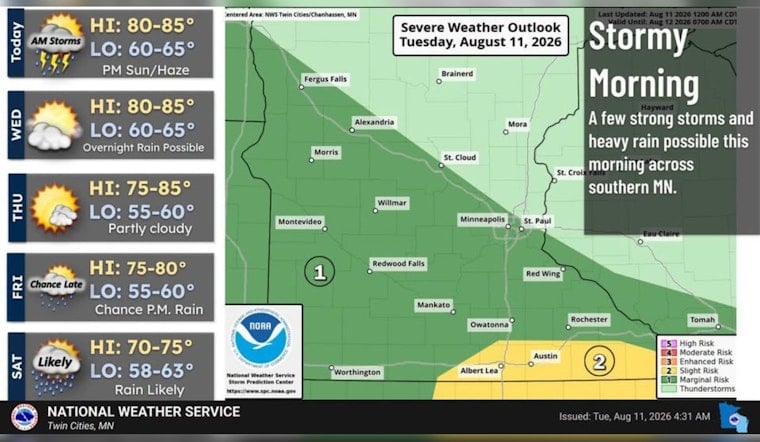
Minneapolis is starting Tuesday, August 11, at about 68°F under mostly clear skies, but the calm opening could give way to a quick round of showers or thunderstorms before breakfast. The daytime forecast calls for a high near 87°F, with skies turning partly sunny and only a 30% chance of precipitation. For most city residents, the bigger story is the sharp turn later this week: cooler temperatures arrive Thursday, followed by the best chance of widespread rain Friday night into Saturday.
Morning Storm Chance Stays Limited
The National Weather Service Twin Cities says scattered thunderstorms are expected mainly across southwest and southern Minnesota this morning, with isolated strong winds, frequent lightning and brief downpours possible in those areas. Minneapolis has a 30% chance of showers and storms before 9 a.m., while new rainfall should remain below a tenth of an inch, according to the National Weather Service.
After the morning window, rain chances drop sharply and the metro should turn partly sunny. East-southeast winds will remain light at 0 to 5 mph, but the combination of afternoon temperatures in the mid-80s and lingering moisture could make the day feel distinctly summerlike.
Cooler Air Arrives Thursday
Wednesday stays mostly sunny with a high near 86°F and an overnight low around 66°F. Thursday brings partly sunny skies and a high near 83°F, followed by a cooler night in the low 60s as northeast winds increase slightly.
Friday Night Into Saturday Looks Wettest
Friday begins mostly sunny, with a high near 79°F and only a slight chance of showers after 1 p.m. The forecast turns more unsettled Friday night, when showers and thunderstorms become more likely, and Saturday could bring a mostly cloudy day with a 60% chance of rain and storms and a high near 74°F.
Sunday should offer a partial reset, with a slight chance of an early shower before partly sunny skies and a high near 77°F. Monday looks mostly sunny and warmer, with temperatures climbing back toward 79°F.





