

























































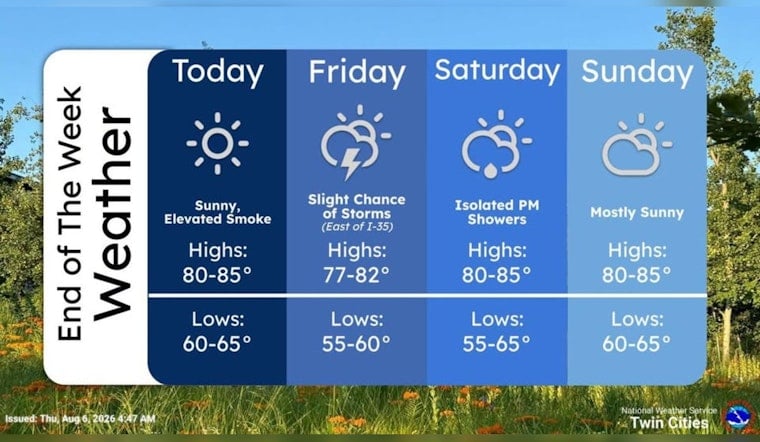
Minneapolis is starting Thursday, August 6, with clear skies and temperatures around 63 degrees, but the day will warm quickly under full sunshine. The high should reach near 85 degrees, with south-southwest winds of 5 to 10 mph and no rain expected. It is a calm opening act before storm chances return to the forecast Friday and again Sunday night.
Sunny Thursday Brings A Warm-Up
Temperatures should climb through the 70s by late morning and reach the mid-80s during the afternoon. Some elevated wildfire smoke could make the sky look hazier later in the day, though the National Weather Service Twin Cities says surface air quality is expected to remain in the Good to Moderate range.
Friday Storm Chances Arrive Around Midday
Friday will stay warm, with a high near 84 degrees, but a 30% chance of rain showers is in the forecast from roughly 9 a.m. to 1 p.m. A chance of showers and thunderstorms follows between 1 and 2 p.m., and a few stronger storms are possible across eastern Minnesota and western Wisconsin, including isolated damaging wind gusts or large hail.
Weekend Starts Quiet Before Sunday Night Turns Unsettled
Saturday looks like the better outdoor day, with sunshine, a high near 84 degrees and only a slight chance of evening showers or thunderstorms. Sunday should be mostly sunny and warm, topping out near 85 degrees, but the forecast turns wetter after 7 p.m. with a 60% chance of showers and thunderstorms continuing into early Monday.
Monday could begin with showers and thunderstorms before 7 a.m., followed by a partly sunny afternoon and a high near 82 degrees. No weather alerts are currently posted for the Minneapolis forecast area, but anyone making plans for Friday afternoon or Sunday night should keep an eye on updated storm timing.





