

























































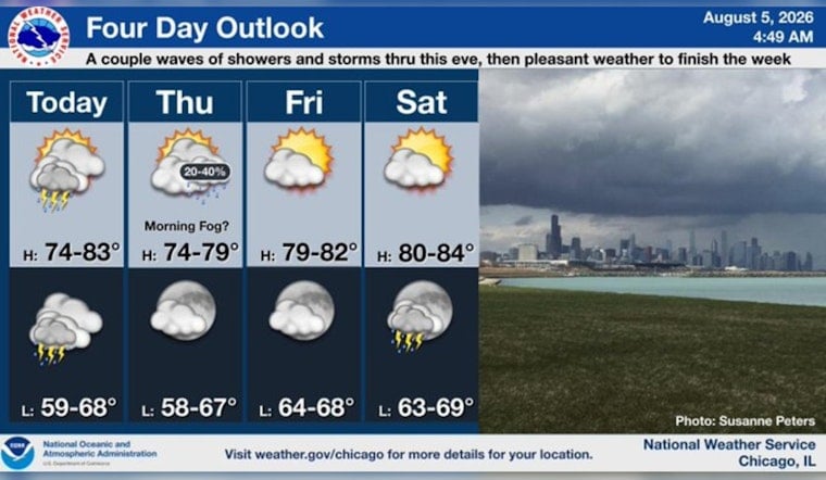
Chicago woke to mostly clear skies and temperatures around 73 degrees Wednesday, but the quiet start is expected to give way to a stormier day. Showers and thunderstorms may arrive in waves, with the heaviest downpours possible from late afternoon into Wednesday night.
The latest observation from Midway showed south-southwest winds near 20 mph, while the forecast calls for lighter southwest winds of 5 to 10 mph through the day. According to the National Weather Service Chicago office, temperatures should reach near 80 degrees before slipping into the upper 70s during the afternoon.
Downpours Could Complicate Wednesday Evening
There is a slight chance of showers and thunderstorms during the morning, followed by a better chance through early afternoon and another round late Wednesday. Rain may ease for a time before storms redevelop, with roughly a quarter- to half-inch of rain possible during the day.
Showers and thunderstorms are likely Wednesday night, when the rain chance rises to 60% and another half-inch to three-quarters of an inch could fall. Repeated downpours over the same areas may create localized flash-flooding concerns, especially where water already collects quickly.
Thursday Brings A Cooler Break
Thursday should be noticeably cooler, with only a slight chance of an early-morning shower or thunderstorm before partly sunny skies take over and temperatures top out near 75 degrees. The overnight low should fall to about 66, followed by a partly sunny Friday with a high near 81.
Storm chances return Friday night and remain part of the forecast through the weekend and into early next week, including a warmer Sunday near 84 and Monday near 83. No watches, warnings or advisories are currently listed for the Chicago area, but commuters should allow extra time for wet roads and avoid driving through standing or moving water.





