

























































A hiker who trusted Google Maps as his only guide through Linville Gorge ended up spending a cold, foodless night stranded off-trail, deep in one of North Carolina's most rugged wilderness areas, before rescuers reached him the next morning. Officials said the app is simply not built for the kind of terrain found in the gorge, and the hiker paid for that mismatch with a night he never planned for.
The ordeal began when the hiker took a wrong turn in the Chimney Gap area and followed a side trail that dead-ended at a water source, according to the Charlotte Observer. Rather than turning back toward a marked route, he continued off-trail into the gorge until dark fell, eventually crossing the Linville River as he tried to find his way out. Officials said the hiker had become lost after relying on Google Maps as his only navigation source, and by nightfall Saturday he was stuck with no food, water, water filter, shelter, or backup navigation tools.
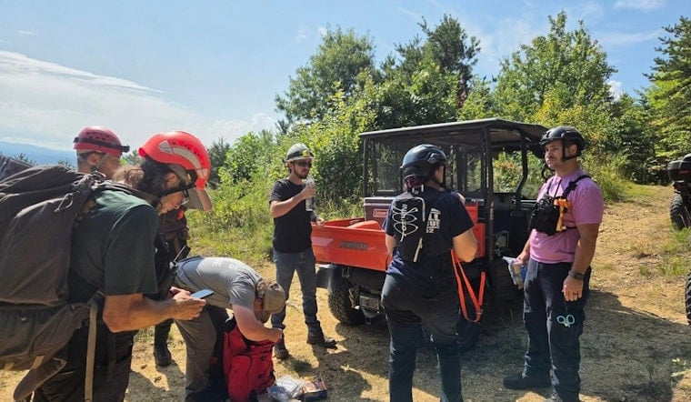
He spent Saturday night stranded in the gorge before calling 911 for help Sunday morning, per the same account. That call set off a multi-agency response, with Burke County Search and Rescue dispatching crews on foot from the Table Rock picnic area while a second team deployed on ATVs and UTVs. The rescue also drew assistance from the Burke County Emergency Services and Emergency Management Office, the Oak Hill Fire and Rescue Protection Association, and Lake James Fire and Rescue Station 68, the report notes.
An Hour of Bushwhacking to Reach Him
Ground teams used the Mountains-to-Sea Trail to reach the general area, then spent about an hour bushwhacking off-trail before finding the hiker roughly half a mile down from the ridgeline, away from any established trail. He was not injured, and rescuers gave him water and electrolytes before helping him back to the Mountains-to-Sea Trail and to waiting ATVs, the article states. Thunderstorms rolled into the area during the evacuation, adding one more complication to an already difficult extraction.
Linville Gorge is known for steep, rugged terrain studded with rock formations and dense hardwood and pine forest, sitting roughly 110 miles northwest of uptown Charlotte by road and forming part of Pisgah National Forest. The gorge's walls drop 2,000 feet into the valleys below, a scale that helps explain why a single missed turn near Chimney Gap can strand someone far from help. Wes Taylor, chief of Burke Rescue Squadron, has spoken to the risks the terrain poses for hikers who wander off established routes.
Why Wilderness Trails Are Left Unmarked
Part of what makes navigation so tricky in the gorge is by design. Under U.S. Forest Service guidelines for the Linville Gorge Wilderness, trails inside the wilderness boundary are intentionally left unblazed and unsigned, with the Mountains-to-Sea Trail as the lone exception, according to Burke County Search and Rescue. That approach is meant to preserve primitive wilderness conditions in the 11,786-acre Linville Gorge Wilderness, designated in 1964 as one of the original areas in the National Wilderness Preservation System, per the USDA Forest Service. Without artificial trail markers, hikers relying on a phone screen have little to correct course once they stray.
That tension between digital convenience and wilderness policy is showing up well beyond western North Carolina. Search and rescue organizations across North America warned in August that Google Maps frequently miscalculates wilderness routes, in one case estimating an 18-mile alpine trek with 6,000 feet of elevation gain would take just 5 hours when it realistically takes 12 to 14, according to TheTravel. Earlier this month, three climbers had to be rescued from Mount Shasta after leaning on Google's Gemini AI chatbot and Google Maps for route planning and packing advice, leaving them stranded without adequate gear, as reported by Inc. Hoodline covered that incident in a report on the AI-botched route.
A Familiar Strain on Local Rescue Crews
This kind of call is far from rare for Burke Rescue Squadron, which responds to roughly 100 search and rescue calls and about 2,400 emergency medical calls annually across rugged regional terrain that includes Linville Gorge, according to the Burke Rescue Squad. Squadron volunteers and partner agencies also carry out 20 to 30 high-angle or technical carryout rescues each year across Linville Gorge, Table Rock, and Shortoff Mountain, terrain where steep rock faces and dense forest make standard evacuations impossible without UTVs or manual stretcher carries. Just a week before this hiker's ordeal, emergency crews from 24 regional agencies conducted a complex rescue in the gorge that included an EMT running 1,000 vertical feet with blood to treat an injured climber on Shortoff Mountain, a mission Hoodline detailed in coverage of the Shortoff Mountain fall.
The Forest Service requires camping permits for the Linville Gorge Wilderness on weekends from May through October to limit visitor numbers and protect wilderness character, though day hikers need no permit at all, per Recreation.gov. That heavy weekend traffic places real strain on the limited Forest Service staffing assigned to the Grandfather Ranger District. Meanwhile, conservation groups have continued working to protect the land around the gorge; in 2020, The Conservation Fund and the Forest Service expanded Pisgah National Forest by acquiring 205 acres at Long Arm Mountain, safeguarding watershed tributaries that flow into the Linville River, according to The Conservation Fund.
There's also a technical vulnerability at play whenever hikers lean on phone GPS in places like Linville Gorge. Wilderness search and rescue teams warn that continuous phone GPS tracking drains device batteries quickly in remote areas with weak cell coverage, potentially leaving stranded hikers without lighting or a way to call for help, according to The Independent. For now, it remains unclear whether digital mapping providers will add automated backcountry warnings for wilderness zones, or whether federal land managers will step up trailhead education about the risks of trusting an app built for city streets in a place with none.





