

























































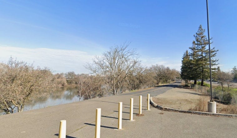
Sacramento's long-stalled dream of a continuous river trail hit another snag this week after state flood officials signed off on two new private fences slicing across the levee in the Pocket and Greenhaven neighborhoods. The approval keeps a roughly four-mile gap in place along a route that trail advocates have pushed to complete for more than five decades, and it puts the city's threat to use eminent domain squarely back in the spotlight.
The Central Valley Flood Protection Board unanimously approved the two fence requests, according to CBS Sacramento. One of the approvals allows Renee O'Neil, whose family has owned a riverfront home for 36 years, to build a new six-foot-tall fence across the levee behind her property. O'Neil told the station she is passionate about maintaining private property rights and believes restricting public access with the fence actually helps protect the levee itself, arguing it will help prevent unauthorized entry onto her land and guard against trespassers.
The proposed trail, which would run through Sacramento's Pocket and Greenhaven neighborhoods south of downtown and west of Interstate 5, is meant to eventually link with a much larger regional network. Once finished, the connected route could allow travel for more than 40 miles between Freeport and Folsom Lake. The completed Sacramento River Parkway is also envisioned as a piece of the Great California Delta Trail, a broader initiative intended to link Sacramento's regional trails to state parks and multi-use paths extending toward the San Francisco Bay Area, according to the Sacramento River Parkway Coalition.
Why Homeowners Still Control the Levee Crown
The reason private landowners have the legal standing to fence off the levee at all traces back to how the neighborhood was originally platted. Subdivisions in Sacramento's northern Pocket neighborhood built before 1970s amendments to California's Subdivision Map Act were never required to dedicate public access easements along the waterway, according to Inside Sacramento. That left private land titles extending directly to the river's edge, a legal quirk that still shapes the fight today.
State regulators say their hands are largely tied by that same legal reality. Following the June fence permit approvals, Central Valley Flood Protection Board officials clarified that state regulations limit the board's review criteria strictly to an encroachment's structural impact on levee flood performance, regardless of the city's trail ambitions, per the Water Education Foundation. Flood engineers reportedly said the newly approved fences will not affect the levee's structural strength, and officials noted that portions of the fences can be removed when water levels rise.
City Threatens Eminent Domain
Mayor Kevin McCarty has made finishing the trail a priority of his administration, and he did not hold back after the board's vote. “This is a big issue for Sacramento,” McCarty said, adding that the Sacramento River should be accessible to the public and that the city is trying to open public access to a public river. McCarty had urged the Central Valley Flood Protection Board not to approve additional private fencing before the vote went forward anyway.
Sacramento is now willing to consider using eminent domain to acquire the property needed to complete the trail, and city leaders are expected to discuss that option next month. The stakes are significant: a City of Sacramento appraisal study found completing the parkway requires acquiring public access easements across 38 private properties in Little Pocket and 72 more in Greenhaven and Middle Pocket, with another 35 parcels along the corridor already publicly owned. Homeowners along the route have said the fences protect their property and address ongoing trespassing and crime concerns.
A Half-Century of Waiting
For longtime advocates, the latest setback lands as one more delay in a saga that has dragged on since before many current residents were born. Walt Seifert has waited for the trail since 1975, when the city first formally established its vision for a continuous Sacramento River Parkway meant to mirror the American River Parkway. Seifert called the latest fence decision frustrating and said everybody loves the river and should have access to it, adding that he hopes the trail becomes a reality in his lifetime.
Trail advocates argue the stakes go beyond recreation. Cross-levee fences, they say, can create a flood hazard during extreme river flows because trapped floating debris can redirect water currents against the levee bank and accelerate erosion, according to the Sacramento River Parkway Coalition. Their broader goal remains eliminating the remaining gap in the trail project, a piece of unfinished business that has persisted even as other pieces of the region's active-transportation network have come together — including the nearby $23 million Del Rio Trail Bridge over Interstate 5, which opened in December and completed a 4.8-mile rail-to-trail route designed to feed directly into the river parkway.
Complicating the picture further, the U.S. Army Corps of Engineers has been carrying out a $1.8 billion levee modernization project along the same stretch of the Sacramento River from 2020 through 2027, installing underground cutoff walls and bank erosion protection through the Little Pocket and Big Pocket areas. With federal crews already reinforcing the levee and the city eyeing eminent domain as its next move, the fate of Sacramento's long-promised riverfront trail may ultimately hinge less on engineering than on who ends up holding legal access to the levee crown.




