

























































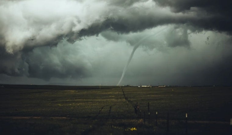
A fast-moving storm cell near Suntree prompted the National Weather Service to issue a Tornado Warning for Melbourne and surrounding parts of Brevard County at 5:47 p.m. Friday, after Doppler radar detected rotation capable of producing a tornado. The storm was tracked moving southeast at 15 mph, with rotation indicated roughly seven miles north of Camp Holly Fish Camp.
According to WKMG ClickOrlando, News 6 meteorologist Jordan Patrick broke down the threat live on air and on News 6+ as the warning unfolded, walking viewers through what they needed to know in real time. The station's report, published Sept. 5, was credited to producer Chris Raines. Alongside the tornado alert, NWS Melbourne also issued a Severe Thunderstorm Warning in effect through 6:15 p.m., covering Satellite Beach, June Park, and Palm Shores, as detailed by Space Coast Daily.
A Stormy Labor Day Weekend Setup
Friday's sudden severe weather wasn't an isolated blip. It coincided with an unsettled Labor Day weekend pattern across Central Florida, with rain chances running 50% to 70% as Atlantic and Gulf sea breezes collided, according to ClickOrlando. Those collisions can create localized boundary zones where brief rotation forms quickly, turning an otherwise routine summer storm into a tornado-warned cell within minutes.
Under National Weather Service emergency guidance, residents inside an active tornado warning polygon are told to move immediately to an interior, windowless room on the lowest floor of a sturdy structure, avoiding mobile homes and vehicles, per Space Coast Daily's report on the warning. Airborne debris accounts for the majority of injuries and deaths during tornado events, which is why officials stress getting away from windows and exterior walls as quickly as possible.
Why Some Phones Buzzed and Others Didn't
Friday's Tornado Warning would have triggered automatic Wireless Emergency Alerts on mobile phones in the warned area, since federal protocols reserve those automated blasts for full Tornado Warnings or “destructive” severe thunderstorm warnings, as Hoodline previously reported. Lower-level “tornado possible” tags, by contrast, do not trigger those automated phone alarms, a distinction the National Weather Service built into its alert thresholds in 2021 to reserve the loudest warnings for the most severe hazards.
Brevard's Recurring, Often Overlooked Tornado Risk
While hurricanes tend to dominate Florida's severe weather coverage, tornadoes can pose a recurring threat in Brevard County specifically. The county's coastal position leaves it exposed to both winter frontal tornadoes and summer sea-breeze spouts like the one that prompted Friday's warning.
That risk isn't purely theoretical for the region. Brevard County has experienced tornadoes before. Statewide, weather-related hazards have caused fatalities in Florida.
Saturated Ground Adds to the Danger
Compounding Friday's severe weather risk, storms can also bring falling trees and power outages.
Not every dramatic-looking storm scar in Brevard is actually tornado damage, either. Localized downbursts can also produce storm damage. It remains unclear whether Friday's warned storm near Suntree produced a confirmed touchdown or any structural damage after the warning expired at 6:15 p.m.
Friday's alert also fits a broader pattern this year across Central Florida, with Hoodline having covered severe storms along the I-4 corridor in June and a similar tornado threat in Jupiter and Palm Beach Gardens in August.





