

























































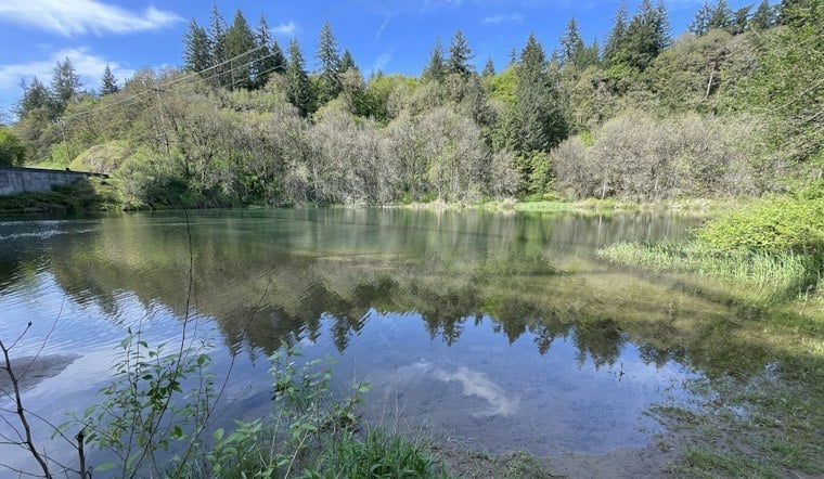
Crews have finished carving new channels into three miles of the East Fork Lewis River near Ridgefield, undoing decades of damage from gravel mining and floods, and salmon are already taking advantage of it. Chum, coho and Chinook have been observed spawning in the newly reconnected river, marking an early payoff for a project that took roughly a decade of planning and nearly two years of construction to complete.
The East Fork Lewis River Reconnection Project formally wrapped up this month, with officials, contractors and community members gathering on October 15 to celebrate construction completion, according to The Columbian. The project, led by the Lower Columbia Estuary Partnership in collaboration with Clark County and a mix of public, private and tribal partners, returned a 3-mile stretch of the river to something close to its pre-European settlement condition. Crews used heavy equipment to carve out new channels and regrade roughly 300 acres of floodplain, according to the same report.
Undoing Decades of Gravel Mining Damage
The East Fork Lewis River is the largest free-flowing river in Clark County and supports steelhead and other wildlife, but it hasn't flowed naturally in generations. By the 1960s, the river had been constrained to a single channel to allow gravel mining operations, The Columbian reported in a September 2025 update. The 1996 floods later caused the river to break through a haul road and spill into abandoned gravel pits, scrambling the floodplain even further, and recent high-water events have continued pushing sediment, sand and gravel beyond the riverbanks.
Clark County had envisioned developing a river greenway along the corridor for more than 40 years, and the county has acquired or contributed to acquiring nearly 2,500 acres along the river over that span. As part of the project, a portion of a Clark County maintenance yard was relocated out of the 100-year floodplain to higher ground, and the former yard site was restored to floodplain habitat, according to the Lower Columbia Estuary Partnership. More than 81,000 juvenile lamprey, 45,000 freshwater mussels, 46,000 fish and more than 50 native painted turtles were relocated from within the project boundary before construction began.
New Channels Already Drawing Salmon
Three new channels were built to restore the multi-channel network that existed in the valley before development took hold, and more than 3,000 feet of new channel now runs downstream of the Danger Park/East Fork Lewis River Greenway Trail on the eastern floodplain, per the Estuary Partnership. The project spans more than three river miles from Lower Daybreak Regional Park to Cemetery Bend. The Lower Columbia Estuary Partnership also completed work on the eastern side of the property in 2026, including filling in former gravel pits seven, eight and nine, while the former pit six area was transformed into a meandering side channel connected to a wetland.
Wetland vegetation grew well in the year after construction finished in that area, and a beaver has since established a small dam downstream of the western side channel. That dam helped maintain a consistent water level in the channel through drought conditions that extended into October. Juvenile salmonids have been gathering near newly installed wood structures that provide cold water and shelter from vegetation, while the Washington Department of Fish and Wildlife's Chinook monitoring team has surveyed the river weekly, mapping adult salmon redds and identifying nests within the project area — including in sections where fish were observed the previous year.
What's Different About the Cost Figures
The price tag attached to the project varies by source and by date. The Estuary Partnership describes it as a $23.5 million effort, while The Columbian reported a $25 million figure in its October coverage, noting that much of that came from the Washington Department of Ecology's Floodplains by Design program; a Columbian report put the total cost at $15 million. The project separately received $7.6 million in grants from the National Oceanic and Atmospheric Administration, according to OPB, and state Rep. Ed Orcutt is credited by the Lower Columbia Estuary Partnership with securing $5 million in financing.
Clark County had closed three river miles downstream from the lower portion of Daybreak Regional Park to boaters and other river users beginning in April so the contractor could build the project, according to Clark County Public Works. The first phase of construction broke ground that same month in 2025, and staff had already spent roughly ten years on planning, design, grant applications, permitting and resident outreach before shovels hit the ground, The Columbian reported.
Next Up: 100,000 Plants This Winter
The work isn't entirely finished. Crews and volunteers plan to plant 100,000 native plants, shrubs and trees on the east side of the project in the coming months, according to The Columbian's account of the completion celebration, with plantings and seedings expected to continue through fall and winter per the Estuary Partnership. Additional planting is also planned for the western floodplain side channel and the main river, with the restoration planting plan calling for upwards of 25 species of woody plants ranging from shrubs to trees, including roughly five or six types of willow. The next phase of work will focus on planting and observing how the river responds to seasonal flows.
The Lower Columbia Estuary Partnership has also secured about $300,000 in funding for ongoing monitoring now that construction is complete, per The Columbian. The newly built channels are designed to bring additional flow onto the floodplain, recharge groundwater, supply cool water for salmonids during hot summer months and reconnect existing wetlands to the river, according to the Estuary Partnership. A functioning floodplain of this kind can also store water during high flows, helping protect downstream communities, and officials say the wider, shallower floodplain is expected to slow erosion and reduce flood risk, as OPB reported.
The project drew support from state and federal agencies, Clark County, tribal governments, conservation organizations, private partners and volunteers. The Reflector reported that salmon recovery planning for the region was first adopted in 2004, long before this particular reconnection effort broke ground. Dean Reynolds, vice chairman of the general council of the Cowlitz Indian Tribe, and Sue Marshall, Clark County council chair, were among those connected to the project, per the same report.



