

























































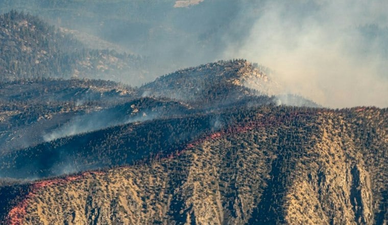
A wildfire burning near Lake Isabella has prompted evacuation orders and is threatening homes on the lake's east side, as fire crews work to box in the flames in rugged Kern County terrain. The blaze, dubbed the Cyrus Fire, ignited Friday afternoon and has since grown to hundreds of acres, with containment efforts making steady progress through the weekend.
The fire began at 2:24 p.m. Friday, October 9, 2026, near Cyrus Canyon Road and Sierra Way in Lake Isabella, according to modbee.com. By Saturday evening, the outlet reported the fire had burned 543 acres, an increase of one acre since its previous update, while a separate report from kget.com cited the Kern County Fire Department putting the burned area at 450 acres in Kernville. The discrepancy between the two acreage figures has not been resolved.
Containment reached 50% as of Saturday noon, the same report noted. The fire has a moderate rate of spread in the area of Lake Isabella, and structures are threatened on the east side of the lake, according to fire.ca.gov. The blaze is being managed under unified command by the Kern County Fire Department and the U.S. Forest Service's Sequoia National Forest, per the same account from the Modesto Bee.
Evacuation Zones and Shelter Set Up in Kern Valley
Authorities issued an evacuation order for zone KRN-761, along with evacuation warnings for zones KRN-760-B and KRN-768, the station's report states. An evacuation shelter has been set up at Kern Valley High School, located at 3340 Erskine Creek Road, with large-animal assistance available at John E. McNally Arena, the report adds.
As of the available updates, the cause of the Cyrus Fire remained unknown, with no information yet released on what sparked the blaze. The San Francisco Chronicle has been tracking the Cyrus Fire as part of its ongoing California fire map project. The San Francisco Chronicle notes its fire labels apply to blazes larger than 500 acres, fires causing property damage, or those causing injuries or deaths.
How the Fire Is Being Tracked
The Chronicle's map tracks the Cyrus Fire.
The Chronicle's map also includes hot spots.





