

























































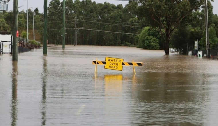
A woman was pulled from her vehicle Wednesday after floodwater rose to her windows near NE 39th Street and Stiles Avenue in Oklahoma City, as fast-moving storms dumped heavy rain across the metro and turned roadways into rivers. Officials said the water surrounded her car before rescuers reached her, and aerial footage captured by SkyNews 9 showed the vehicle stranded in the rising current.
The rescue unfolded as part of a broader severe weather event that News 9 has been tracking across Oklahoma, with storms, flooding, road conditions, and other impacts unfolding in real time throughout the day. The outlet's live coverage, reported by digital producer Cassidy Mudd, who joined the News 9 team in June, detailed how quickly the floodwater engulfed the area near NE 39th and Stiles.
Tropical Moisture Collided With a Stubborn Plains Trough
The storms tracing across Oklahoma drew their fuel from tropical moisture pulled north from the remnants of Hurricane Polo as they interacted with a slow-moving upper-level low-pressure system parked over the Plains. A KNPR report linked flash flooding to Polo's remnants and a low-pressure system. That combination set the stage for the kind of sudden, intense downpours that caught drivers off guard Wednesday afternoon.
The National Weather Service Weather Prediction Center had placed Oklahoma City and parts of central Oklahoma in a Level 3 out of 4 Moderate Risk for excessive rainfall and flash flooding for the day, per the same KNPR report. A Weather Prediction Center Mesoscale Precipitation Discussion issued Wednesday warned that rainfall rates could exceed 2 inches per hour as repeating thunderstorm cells tracked across the same stretch of central Oklahoma, according to a forecast discussion shared by meteorologist Christopher Nunley.
Parched Ground Made Flash Flooding Worse
AgroLatam reported dry conditions and a moisture deficit in Oklahoma, with 81 percent of the state's topsoil moisture classified as short or very short. That drought-hardened ground could not absorb the sudden burst of heavy rain, which instead ran off rapidly into urban drainage corridors and low-lying intersections, according to Nunley's forecast notes.
In response to the threat, the National Weather Service in Norman issued a Flood Watch for Oklahoma County and surrounding areas across central and southern Oklahoma, running from Wednesday afternoon through Thursday afternoon, Hoodline previously reported. That advisory covered the same window in which the NE 39th and Stiles rescue took place.
Why Floodwater Near a Car's Windows Is So Dangerous
The scene near NE 39th and Stiles illustrates a hazard the National Weather Service has long warned drivers about. As little as 6 inches of fast-moving floodwater can reach the bottom of most passenger vehicles, enough to cause a loss of control or stall an engine, according to National Weather Service safety guidance. As floodwater deepens, it can float passenger cars, and rushing water can sweep away larger vehicles.
Driving into hazardous floodwater can put lives at risk, and flooding can be deadly.
Repeating Storm Cells Make Forecasting Especially Tricky
Repeated thunderstorm cells tracking over the same narrow area can concentrate heavy rain in localized areas.
That pattern tracks with what forecasters saw develop over central Oklahoma, where repeated rounds of heavy rain concentrated over the same corridors rather than spreading evenly across the region. It is a dynamic that has shown up in the OKC metro before, with Hoodline having tracked a string of flood watches and flash flood threats across the area throughout 2026, including episodes in April, May, and June.





