

























































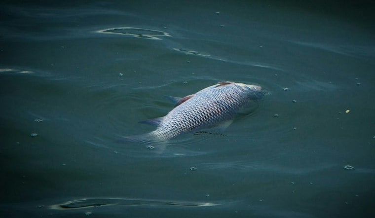
Bloom-level red tide turned up in Bay and Gulf counties in the Florida Fish and Wildlife Conservation Commission's Friday update, and suspected fish kills were reported along that same Panhandle stretch.
The week was not one even blanket of algae. Readings ran from background traces farther west to high concentrations in Gulf County, while a short-range current forecast pointed surface water generally southeast.
In its November 13 status report, FWC said the red-tide organism Karenia brevis was observed in 20 samples from Northwest Florida. Bloom concentrations, defined as more than 100,000 cells per liter, were present in four samples from Bay and Gulf counties.
What the Samples Showed
County ranges in that update were uneven. Escambia County had background concentrations. Walton County had low concentrations. Bay County ran from background to medium, and Gulf County from very low to high.
Outside the Panhandle, the same report found Karenia brevis at background levels in three samples from or offshore of Southwest Florida, including Sarasota County and offshore waters near Pinellas and Collier counties. Along Florida's East Coast, it was not observed over the week covered by the update.
FWC also said respiratory irritation suspected to be related to red tide was not reported over the past week. That is a separate finding from the fish kills, which officials did log in Bay and Gulf counties.
How the Bloom Moved
Local reporting had already been tracking the organism west from St. Joseph Bay toward Bay County. On November 10, the News Herald reported that red tide originating in St. Joseph Bay had spread to Panama City Beach and St. Andrews Bay.
Two days later, the paper described conditions as getting worse across Bay and Gulf counties. Its November 12 account said high concentrations were found off Cape San Blas, medium concentrations near Blacks Island, and low concentrations elsewhere in St. Joseph Bay.
Friday's statewide ranges do not replace that site-level snapshot. They put Bay County somewhere between background and medium, and Gulf County anywhere from very low to high, which is a wide band for one county's coastline.
Fish Kills and Earlier Health Notices
FWC said several fish kills suspected to be related to red tide were reported in Bay and Gulf counties over the past week. Those reports came through the agency's fish-kill hotline and local partners. The update did not list individual kill sites, species counts, or confirmed causes beyond that suspicion.
Health notices had already been issued around some of the same water. The Florida Department of Health in Bay County announced a health alert for waters near St. Andrews State Park based on samples collected November 9, WJHG reported. On November 12, the News Herald said health alerts were in effect for Mexico Beach and across St. Joseph Bay, with a caution at Panama City's downtown marina.
Those notices describe what local outlets reported on those dates. Friday's FWC update did not republish a beach-by-beach advisory list.
Gulf County was already in a hard season before this week's samples. A November 2 local report said the county's coastline had been hit with a severe red-tide bout for the second year in a row, with fish kills and a delayed restocking of a depleted scallop population. Friday's readings still reached high in that county, and suspected fish kills were again reported there.
Clouds, Currents, and the Next Report
Satellite monitoring did not get a clean look at the bloom. University of South Florida and NOAA researchers have been watching nearshore and offshore conditions with satellite imagery, and FWC said images near the bloom were obscured by cloud cover over the previous few days.
The USF-FWC Collaboration for Prediction of Red Tides, included with Friday's update, forecast net southeastern movement of surface waters from Okaloosa County to Citrus County over the following three and a half days. From Hernando County to northern Monroe County, the same forecast called for south-to-southwest transport. Deeper subsurface currents were predicted to run predominantly southeast along the Gulf Coast from Walton County to northern Monroe County.
That is a transport forecast, not a promise that bloom-level water will arrive at any particular beach. Readers can also check NOAA's Gulf Coast harmful algal bloom forecast for ongoing updates.
FWC said its next red tide status report will be issued Friday, November 20. Until then, the clearest official picture remains last week's split result: four bloom-level samples in Bay and Gulf counties, suspected fish kills on that coast, and no red-tide-related respiratory irritation reported statewide.



