

























































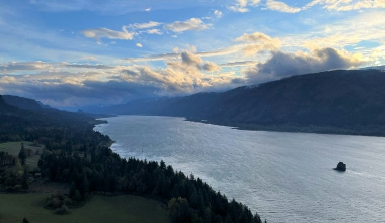
A 20-year-old Portland native has spent the past two months kayaking nearly the entire length of the Columbia River, paddling from the mountains of British Columbia toward the Pacific Ocean in a solo expedition that began with two people and a lot less certainty. Jack Syverson, a Dartmouth College sophomore, calls the journey Headwaters to Horizon, and he is nearing the end of what started as a 1,200-mile trip down one of the West's most heavily dammed waterways.
Syverson launched the expedition at Lake Columbia in Canal Flats, British Columbia, on September 4, a date he documented at the time in a post on the paddling community site community.nrs.com, where he described the undertaking as “1,200 miles and two months away.” He was not alone at the start. Fellow Dartmouth undergraduate Oscar Seltzer launched the trip alongside him, with both students taking a hiatus from their studies to put sea kayaks on the water, according to the same NRS community post.
That partnership did not last the full distance. Seltzer withdrew from the expedition in mid-September because of a medical issue, and Syverson continued the journey alone from that point forward, according to KGW. KGW's report, published as the trip neared its finish, describes Syverson as “nearing the end of a two-month kayaking expedition, discovering the people, places and personal challenges that make the Columbia River unique.”
Fourteen Dams and a Gorge Built for Hard Days
The route Syverson planned involved navigating 14 major dams and making a portage at the Canada-U.S. border, according to the original trip plan described by explorersweb.com. The journey took him through remote mountain valleys, eastern Washington and the Columbia River Gorge, KGW reported. Syverson anticipated that the Gorge would demand some of the trip's toughest stretches, writing that he expected to face “some of our hardest paddling (or even boat hauling) days” there, according to explorersweb.com.
Source-to-sea trips down the Columbia are uncommon. ExplorersWeb described them as “fairly rare,” noting that many of the river's rapids are now submerged beneath reservoirs created by dams. For paddlers, the route means long stretches of flatwater punctuated by repeated portages around hydroelectric infrastructure.
Dams and Salmon Migration
The dams have consequences beyond the portages they require paddlers to make. NOAA Fisheries says dams can impede juvenile salmon migrating to the ocean and adult salmon returning to their natal streams to spawn.
Training for a Trip He'd Never Attempted Before
The logistics began well before launch: Syverson spent six months training for the expedition, according to explorersweb.com. KGW reported that he had not previously attempted serious whitewater or expedition paddling and used that preparation to learn swift-water rescue, wilderness medicine and kayak rolls. He was born in Portland and raised in Kalispell, Montana, KGW reported.
KGW reported that Syverson’s mother, Tami Syversen, followed the route by car, coordinating supplies, meals and river access points. They nicknamed the vehicle “the White Whale”; Syversen camped in it throughout the expedition rather than booking lodging along the way, according to the station.
What the Trip Meant to Him
In comments to KGW, Syverson said the expedition was not about chasing a record. He wanted to experience the river, including interviewing people and talking with locals. He also told the station that before setting out, he did not completely trust himself to pursue challenging goals.
He hopes his experience nudges other people toward their own outdoor pursuits, telling KGW that people do not need a grand, multi-month adventure to find meaning outside — a small joy in the outdoors is enough. Syverson has documented the trip on an Instagram account under the handle @headwaterstohorizon, per KGW's reporting.
How It Compares to Shorter Columbia Paddles
Most paddlers who take on the lower Columbia do it in a fraction of the time and distance Syverson covered. Oregon travel writers Brooke Jackson and Lindsey Atterbury kayaked from Portland to Astoria in just four days, according to traveloregon.com, with their first day alone covering a 25-mile stretch to Sand Island near Saint Helens. Closer to the river's mouth, the Lower Columbia Estuary Partnership lists a shorter 7-mile paddle from the John Day River to Astoria's West Mooring Basin, rating it intermediate skill level, according to estuarypartnership.org. That group also warns that the Astoria-area waters can turn rough fast, with tide rips near Tongue Point and a wind-against-tide pattern that kicks up chop and whitecaps.
Those comparisons underscore just how much ground Syverson's 1,200-mile route covers relative to the recreational paddles most people associate with the lower river. Where Jackson and Atterbury's trip was measured in days and the Estuary Partnership's recommended routes in single-digit miles, Syverson's expedition stretched across an entire international river system, dam by dam, over two months.



