Traveling westbound on Geary Boulevard, it’s hard to miss the cluster of green fields and playgrounds between Steiner and Scott streets in the Western Addition. Hamilton Recreation Center and the Raymond Kimbell Playground and Athletic Fields are located on both sides of Geary and regularly hum with activity.
The playgrounds, tennis courts, athletic fields, basketball courts and indoor swimming pool attract people of all ages and interests from the neighborhood and beyond. But some may not know that the story of how these two parks were formed is woven into the city’s complex and sometimes controversial land use and redevelopment history.
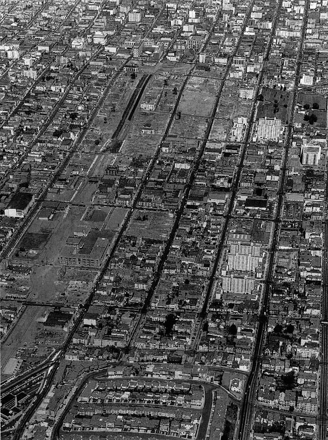
Named after John W. Geary, San Francisco’s first mayor, the expressway that now bisects the Western Addition and Japantown was a more humble street during the city’s early days of westward expansion in the 1850s, and was used direct route west from Union Square to undeveloped land and windswept sand dunes. In 1851, the western city boundary was set along what is now Divisadero Street. The land that Hamilton Recreation Center occupies today was then called Hamilton Square, and it was a place to escape from the chaos of the crowded and growing new city with a population of nearly 35,000 people.
One of 22 city parks and squares existing at the time (today we have more than 220 parks, playgrounds and open spaces and a population of about 850,000), it offered a large lawn, a few trees and a place for families to gather for picnics, clean air and exercise. True to its name, the park was originally a square rather than its current rectangular configuration, listed in the 1861 street guide as spanning Geary and bounded by Post, Steiner, O’Farrell and Scott streets.
By the 1870s, as part of a deal with the Board of Education, the park had been reduced to the area north of Geary, making way for construction of the Girl’s High School at the southeast corner of Geary and Scott, which was later replaced with Benjamin Franklin Middle School and now Gateway High School.
In June 1890, the San Francisco Chronicle published an article about the parks in the city, reflecting on the rapid growth and the foresight of city leaders to set aside open space for the growing population.
As the city grew and reached out into the sandhills there were those who were wise enough to recognize the fact that this was to be the seat of a large permanent population, and that in time there would be a pressing necessity for healthy spots in various localities. In surveying the city, therefore, many blocks were dedicated to the public for use as parks…
The parks were soon to play yet another role for the citizens of San Francisco. After the earthquake and fires in 1906, Hamilton Square, along with other parks in the city, was temporarily populated with shacks for the multitudes left homeless by the destruction.
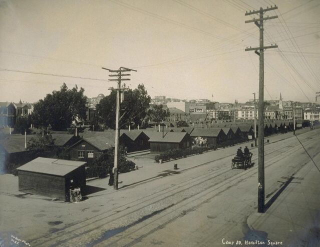
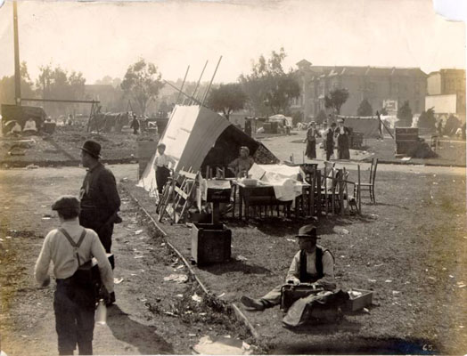
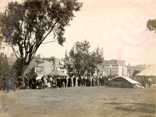
Earthquake refugees and a bread line in Hamilton Square. Photo: San Francisco History Center, San Francisco Public Library)
The Western Addition was spared from the fires, and immediately after the earthquake it experienced a renaissance. Pushing west of the city blocks consumed by the fire, businesses relocated to the area and the neighborhood became more densely populated. In the coming decades, Hamilton Square became a popular place for outdoor concerts and community events. After 1908, the park was transferred from the Parks Commission to the newly formed Playground Commission (later Recreation Commission). Plans were made for a public playground, tennis courts and baseball diamonds, securing the park’s role it still serves today as a center for recreation.
One hundred years after the creation of Hamilton Square, urban renewal was underway in the Western Addition. In the 1950s and '60s, over 100 acres of commercial and residential blocks were cleared as part of the San Francisco Redevelopment Agency’s “Redevelopment of Western Addition Project A-1” to eliminate blight, make way for new buildings and high rises, and widen Geary into a multiple-lane expressway, promising prosperity that was never realized.
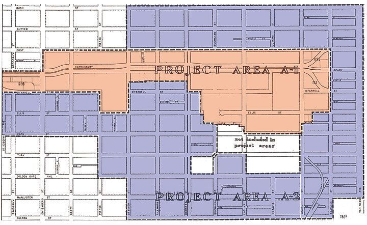
In order to have enough right-of-way for an expanded Geary Boulevard, land from Hamilton Square was needed. A strip along Geary of almost an acre and a half of the 5.4-acre park was necessary for the roadway expansion, substantially reducing the usable space of the park.
To offset this loss of parkland, the Project A-1 boundaries expressly included an expanded park area south of Geary Boulevard adjacent to the school. In August 1951, the Chronicle reported plans for a 6-block recreation area bounded by Geary, Steiner, Eddy and Scott streets.
Raymond Kimbell, then an employee of the San Francisco Recreation & Parks Department and its future general manager, played a significant role in pushing for this park expansion. In 1965, the completed park was named after him to recognize his efforts.
Buildings were razed within the six-block area, with the exception of the Girls’ High School, and O’Farrell Street was filled in between Steiner and Pierce as part of the new park. Paradoxically, the widespread destruction of businesses and residences that forever changed this neighborhood also expanded land for public recreation that the community continues to enjoy today.
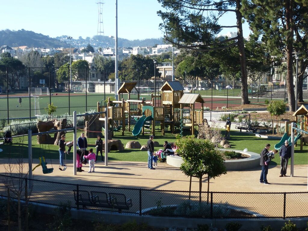
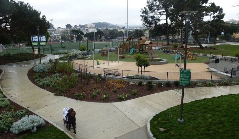
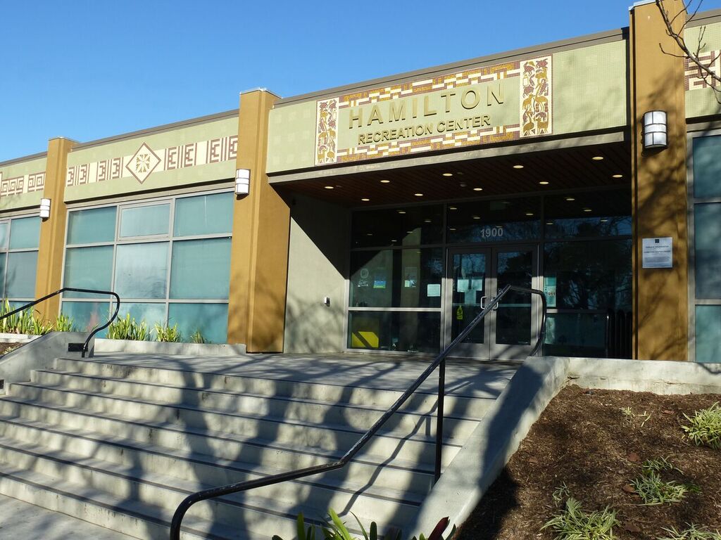
The San Francisco Recreation and Parks Department operates both parks, which are linked with a pedestrian overpass spanning Geary Boulevard. Kimbell Playground, the athletic fields and the Hamilton Recreation Center have all been upgraded in recent years in partnership with neighborhood community organizations and public input.
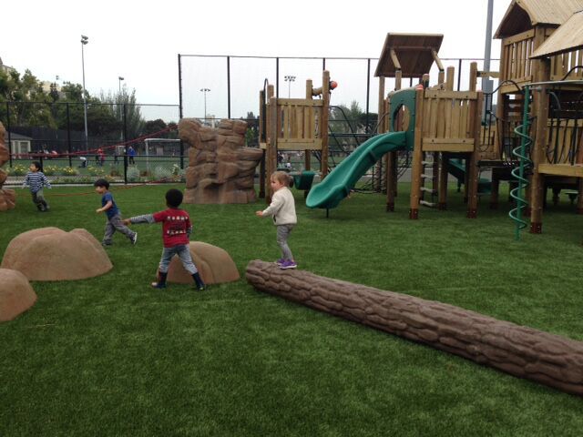
The playground was in major need of an upgrade. Along with the recently renovated Hamilton Recreation Center and Kimbell Athletic Fields, the playground provides a destination for the neighborhood to play, picnic, and relax, said Joey Kahn of the San Francisco Recreation and Parks Department. On a sunny day, you can find over 50 children climbing and jumping at Kimbell Playground.
Jason and his 14-month-old son Ethan were visiting the playground on a recent morning. They live only a few blocks away, and Jason walks with the stroller to the playground two or three times a week. "If my wife and I didn’t work, we would bring Ethan here every day," said Jason. "It’s really important to get him outside."
Getting there: Muni’s 38-Geary bus serves both parks and the 22-Fillmore and 24-Divisadero buses stop within two blocks.


