It's long been a dream for pedestrians and cyclists. But unless you've got wheels, making a trip across the Bay Bridge remains an impossibility.
When the bridge's new east span opened in 2013, the 15-foot-wide shared-use path that debuted with it was essentially a "bridge to nowhere." Later in 2016, the path was extended as far as Yerba Buena Island. But there still isn't a clear way to bike or walk into San Francisco from the East Bay.
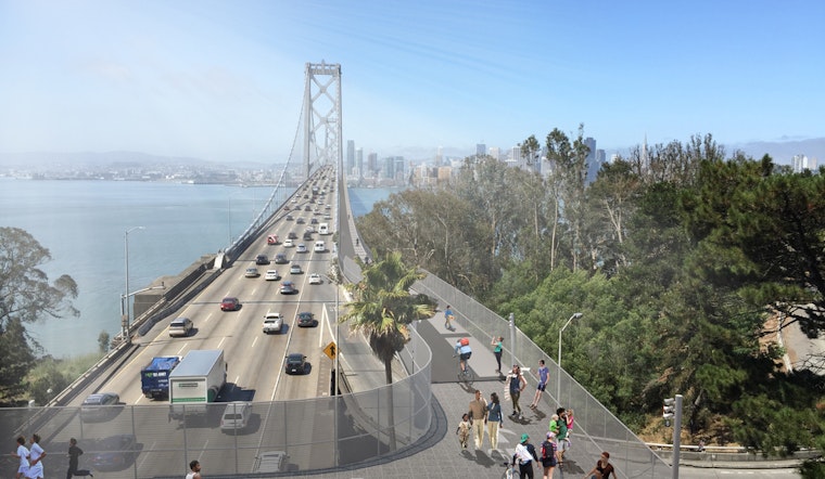
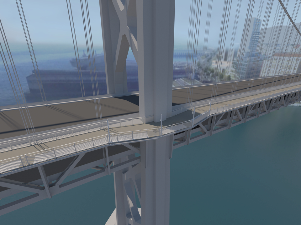
Now, the Bay Area Toll Authority (BATA), along with Caltrans and a team of engineers, have come up with a preliminary design plan to extend the path all the way into the city, via Yerba Buena Island and across the west span of the bridge into downtown San Francisco.
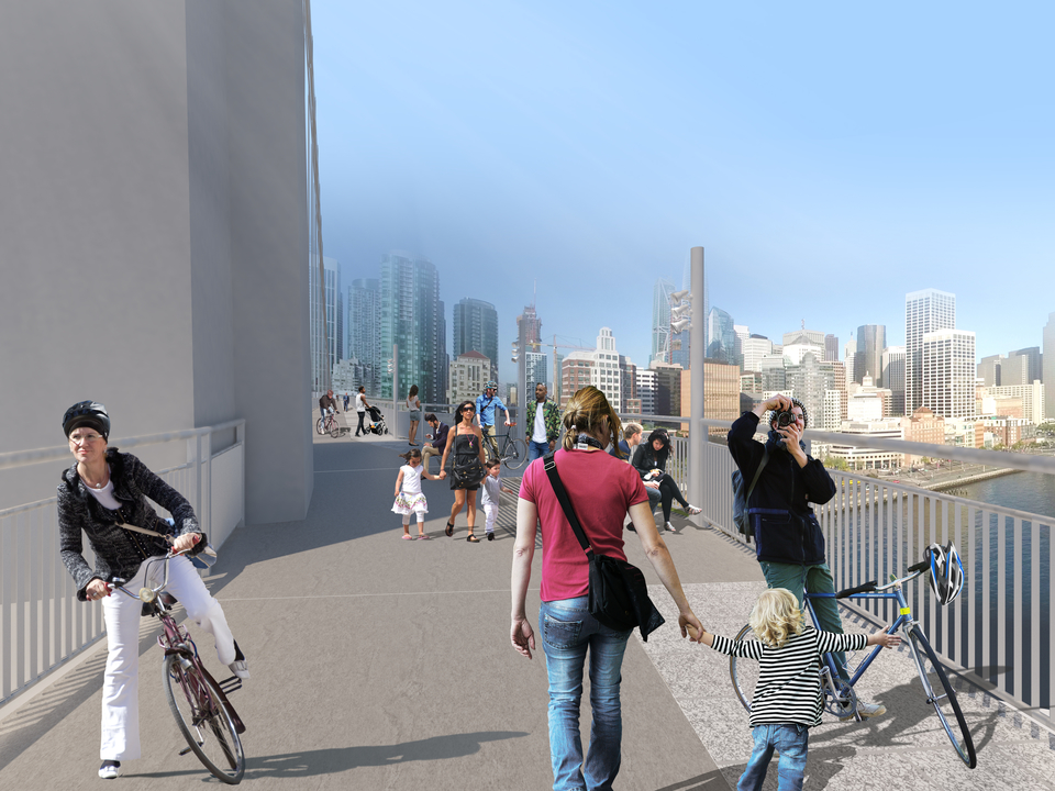
On Monday, November 19, locals can check out the preferred design at a public presentation at the Bay Area Metro Center (375 Beale St.). In addition to a question-and-answer session, the presentation will include a virtual reality experience where you can "stand" on the proposed path.
The idea of including a shared-use pathway connecting Oakland and San Francisco across the bridge was first floated as early as 2001, and again in 2014. But at the time, the concepts studied proved too pricey, and were scrapped.
The newest plan recommends connecting the bridge's east span with Yerba Buena Island via Southgate Road, east of Hillcrest Road. An alignment would then run along the northern side of the west span, with a terminus at Essex Street (between Folsom and Harrison streets) in San Francisco.
If such a project can be pulled off, Caltrans says that the pathway would help maintenance crews as well, reducing the need for traffic-causing lane closures.
The potential sticking point is once again cost, as a funding source for the path has yet to be identified. The Metropolitan Transportation Commission (MTC) estimates that the addition will run "into the hundreds of millions of dollars" — and it says it can't be financed through the bridge's existing toll structure.
If the cash to construct the shared-use path is secured, it's estimated the project will take a decade to complete — three to four years to complete preliminary designs and an environmental review, two years for the final design and right-of-way acquisition, and up to four years for the actual construction.
That will include solving myriad design challenges: seismic safety, the impact of strong winds, shipping and channel clearance, and access for people with disabilities. The project will also need to weigh its environmental impact, and the impact on planned development on Yerba Buena Island and in the city.
The public meeting runs 6–8 p.m. (presentation starts at 6:30 p.m.) on November 19 at the Bay Area Metro Center (375 Beale St.). Light refreshments will be served.
A livestream of the presentation will also be hosted on MTC's Facebook page at 6:30 p.m. To be notified when the presentation is live, respond to the event on Facebook here. Livestream comments will be taken during the question and answer portion of the meeting.


