Many Chicago residents are waking up this Thursday to persistent rain. Isolated thunderstorms are in the forecast for parts of the north-central and northeast regions of Illinois, as well as northwest Indiana, according to a report by the Chicago Tribune.
Midway Airport currently records light rain, fog, and a temperature of 55 degrees. Further north, O'Hare International Airport shares similar weather conditions with a slightly warmer temperature at 57 degrees. The majority of residents should expect overcast skies with intermittent rain, a trend anticipated to last well into the week.
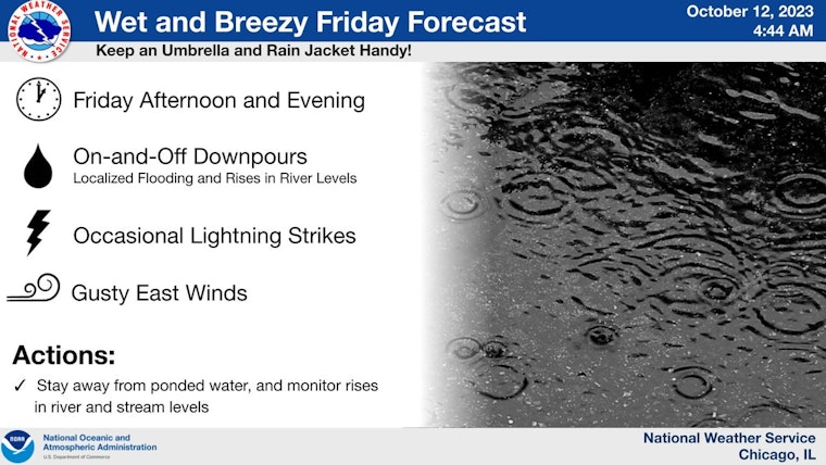
A tweet from the National Weather Service (NWS) Chicago suggests that widespread, heavy rain will likely arrive on Friday, carried by gusty east winds. This pattern of rainfall is likely to raise river levels, and might create instances of flooding in low-lying areas.
Widespread, soaking rain will arrive on Fri with gusty east winds. Repeated rounds of rain will lead to rises in river levels, and may cause ponding in low-lying areas. Keep an umbrella and rain jacket handy! (The severe threat appears to be lowering for our area). #ILwx #INwx pic.twitter.com/ErnpUrcmlg
— NWS Chicago (@NWSChicago) October 12, 2023
Though the threat of severe weather seems to be subsiding in the Chicago area, everyone should maintain ready for the rainy weather predicted to persist until Saturday. The forecast suggests showers and storms, accompanied by east-northeast winds as we move toward the weekend.
Despite enduring the gloomy weather, the NWS tweet hints at some respite for the residents of Chicago, with an improvement of conditions starting Sunday. However, be prepared for possible lake effect showers through Monday, with cool temperatures expected to remain.
With the anticipation of more rain and thunderstorms, Chicago residents are advised to stay vigilant and prepared. Those residing near rivers or in low-lying areas should monitor water levels, take necessary precautions, and stay updated on weather reports throughout the week.


