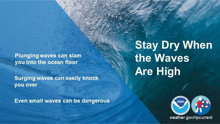
As the North Pacific storm continues to churn with fervor, the National Weather Service has issued severe weather warnings for the San Francisco Bay Area. High Surf Warnings are in effect across all Pacific coastlines until the early hours of Friday, forecasting very high swells capable of producing perilous beach conditions, as reported by weather.gov. Residents have been sternly advised to avoid oceanic hazards, with breaking waves reaching a formidable 28-33 feet along west-facing beaches.
In a statement obtained by NWS Bay Area, the ocean is described as anything but amiable, with dangerous waves that could tower up to 40 feet in "favored locations." The NWS continues to warn of the lethal potential of these conditions, urging the public to maintain a safe distance from rocks, jetties, and piers. The urgency of this warning is echoed on the X page, where #CAwx has become a trending tag for updates on California’s inclement weather.
The ocean is NOT your friend today!
— NWS Bay Area 🌉 (@NWSBayArea) December 28, 2023
High Surf Warning in effect until 3 AM Friday for very dangerous waves up to 28-33 feet, 40 feet possible in favored locations. Stay away from rocks, jetties, piers, and other waterside infrastructure. Never turn your back to the ocean! #CAwx pic.twitter.com/JsR7OmDEkx
Adding to the menacing surf, the region braces for a wet weekend. The NWS forecasts scattered showers, with an additional system on the horizon set to bring more precipitation and strong winds from Friday to Saturday. According to the NWS Bay Area X account, commuters are being encouraged to allow extra travel time and keep a considerable distance between vehicles, as downpours and gusty winds have the potential to cause tree and property damage.
Mariners have not been spared from the storm's wrath either, with a Gale Warning issued for Coastal Waters from Point Arena to Point Reyes, raising concerns about seas reaching a turbulent 11-13 feet. The threat emphasized by this warning stands to capsize or damage vessels, per the urgent marine weather message from the National Weather Service. Additional guidance from weather.gov advises mariners to seek safe harbor and secure their vessels against severe conditions.
The Bay Area's stretch of tumultuous weather doesn't end there. An Area Forecast Discussion made available by the National Weather Service details the relentless pattern expected to continue into the New Year. The impact on the coastline could be significant with hazards coming ashore in high surf and extensive rainfall. The discussion on weather.gov emphasizes the importance of staying out of the water and off coastal infrastructure. As the storm systems march in, alternating periods of rain and gusty winds are forecasted to be a mainstay in the area’s weather for the week ahead.
Residents relying on daily weather predictions should note the latest from the detailed forecast on forecast.weather.gov, which anticipates rain probabilities hovering over 60%, with a chance of thunderstorms Friday night into Saturday. As the week progresses, the pattern appears to maintain a mix of rain and fog, culminating with a higher likelihood of rain each day leading into mid-week.


