SoCal residents, brace yourselves for a wild weather week ahead. The National Weather Service San Diego has forecasted a series of low pressure systems set to unleash rain and mountain snow across Southern California, starting Monday and ramping up into midweek. Temperatures are expected to remain in the 60s in coastal and valley areas. At the same time, the mountains will see chillier conditions, with highs in the 40s and 50s, and the lower deserts staying comfortably in the mid 70s.
In the early hours of today, the National Weather Service reported that a small amount of light precipitation had graced areas over Orange County, the Inland Empire, and northern San Diego County. This moisture was a mere prelude to the more significant downpour anticipated Tuesday afternoon through Wednesday morning when an atmospheric river is projected to bathe SoCal with moderate rainfall.
A High Surf Advisory and Flood Watch have also been announced in anticipation of the severe weather conditions, lasting until Tuesday evening for coastal areas in Orange and San Diego counties. The latter alert raises concerns for potential flooding, particularly in low-lying regions, starting Monday afternoon through late Tuesday night. According to a statement from the NWS, "A narrow band of IVT values of 300-400 kg/m/s (PWATS rise to between 1.00-1.25") will generate rain, moderate at times." Surfers and beachgoers are cautioned as the surf is expected to surge between 6 to 12 feet on west-facing beaches, thanks to swells peaking at 10 to 11 feet.
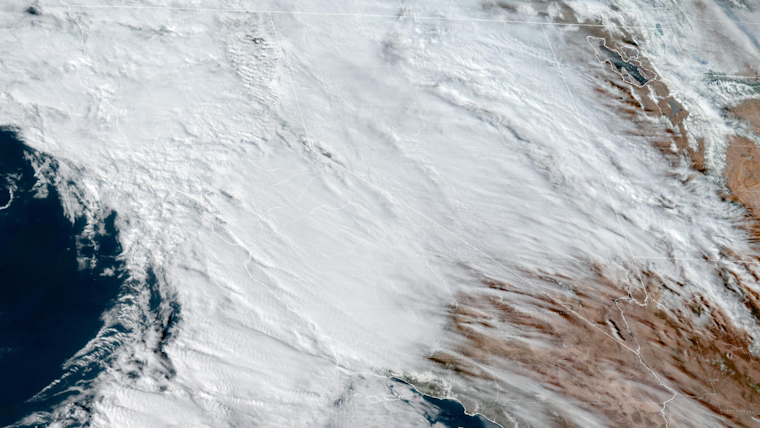
By late week, conditions are forecasted to improve briefly, with weak ridging bringing dry weather Thursday and Friday. However, this respite will be short-lived; another Pacific low is on the tracks toward SoCal, promising a renewed chance for rainfall in the already saturated region early next week. The National Weather Service San Diego's X post from earlier today shared an image taken from the GOES-18 satellite, showing the marine low clouds beginning to dissipate under the watchful eye of high tropical clouds above. Mariners should expect southerly wind gusts near 20 knots on Monday and Tuesday, accompanying the turbulent seas.
First Pacific storm #castorm is going by to our north, meanwhile the marine low clouds continue to burn off with high tropical clouds above, as viewed on GOES-18 satellite on https://t.co/kFRJFPQecO #cawx pic.twitter.com/cKFYUJsaMR
— NWS San Diego (@NWSSanDiego) February 17, 2024
As the first Pacific storm skirts by to our north and with the second poised to strike, local weather authorities are urging residents to prepare for a period of unsettled weather that could impede travel and cause coastal disruptions. It's suggested that folks keep an eye on forecasts and heed any warnings as the situation on the ground could escalate rapidly with the evolving storm systems.


