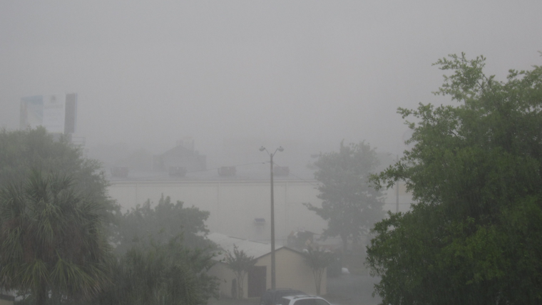
Southern California is bracing for an onslaught of extreme weather as the National Weather Service in San Diego warns of potential catastrophic and life-threatening flooding across several counties, including Orange County and parts of the Inland Empire. According to updated forecasts, an atmospheric river and a low-pressure system off the California coast conspire to bring about widespread moderate to heavy precipitation through Tuesday. The NWS cautions that the heaviest rainfall may unleash catastrophic flooding in Orange, western Riverside, and southwestern San Bernardino Counties.
Rainfall totals are climbing alarmingly, with Lytle Creek in the San Bernardino Mountains registering a staggering 7.22 inches of accumulation. The NWS has issued a stark warning to residents in an X post, urging them to avoid driving through flooded roadways. The floods have begun to take their toll, and with additional rain expected, the scenario is likely to worsen. The NWS has headlined a complete list of storm totals on their website, documenting the impact of the storm across affected regions.
Total rainfall (so far) can be found here: https://t.co/UAtQmHTkpx
— NWS San Diego (@NWSSanDiego) February 5, 2024
Lytle Creek is already up to 7.22 inches! 😱 It's not over yet. Here's the additional rain and snow amounts through Tuesday . We cannot emphasize enough DO NOT DRIVE THROUGH FLOODED ROADWAYS. pic.twitter.com/ERnVbfCSG2
To add to an already perilous situation, the weather service is anticipating significant snowfall across elevated terrains with snow levels expected to drop to around 5500-6000 ft by Tuesday. The mountains could see several inches to several feet of snow, with a Winter Storm Warning issued for elevations above 6000 ft. The combination of heavy rain and snow has the potential to exacerbate flooding and cause additional travel hazards for winter mountain commuters.
Maritime conditions are equally tumultuous. The NWS warns of strong southeast winds through the morning, leading to hazardous seas that could persist into the afternoon. A Small Craft Advisory remains in effect, and boaters are advised to exercise caution. Along the beaches, high surf warnings highlight the risks of strong rip currents and perilous swimming conditions. The NWS further noted in its Area Forecast Discussion that there's a slight chance of thunderstorms extending into Wednesday morning.
In light of the forecast, the NWS has activated flood watches across the region and advises residents to remain vigilant. While emergency services prepare to address the immediate dangers, the weather service encourages the public to monitor updates closely and heed all warnings as conditions evolve. Showers could persist through the week, but a change to fairer, drier weather is anticipated for the weekend, although temperatures are expected to linger below normal. Precautions taken now may make the difference as Southern California faces this formidable downpour.


