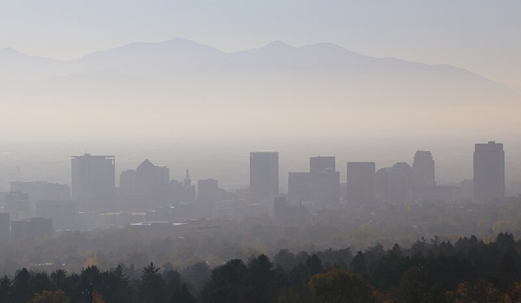
As Salt Lake City braces itself for hazy days, residents can expect little respite from the persistent atmospheric condition. According to the National Weather Service, widespread haze has settled over the region, outlining a forecast that calls for mostly sunny skies nonetheless, with calm winds and mild mid-40s temperatures through the end of the week.
Today's conditions began with a chilly 27°F and visibility reduced to 6 miles, the barometer reading a steady 30.41 in. The forecast indicates a high near 46 degrees, as the calm wind does little to disperse the hovering haze. Similarly, tonight the air will remain thick with particulate matter, the skyline of Salt Lake City, obscured by this haze, is anticipated to be partly cloudy with a low of around 25 degrees.
As we look to Tuesday and the following days, there seems to be a stagnant weather pattern; the haze will persist. Residents should expect sunny days with continuous calm conditions and temperatures peaking just shy of 50°F. The NWS outlines a repetitive sequence stretching into the week, widespread haze by day, partly cloudy to clear evenings, with temperatures dipping into the mid to low 30s at night.
For those with respiratory issues, the constant haze may pose a health concern. It's advised to check air quality reports and minimize exposure during denser periods of particulate matter. Wraparound the week, Friday might bring some mild relief with the haze expected to subside before 10 am, giving way to a mostly sunny day with a high near 46 degrees.
Looking ahead to the weekend, the weather is set to shift slightly with partly sunny skies on Saturday and a high of 49 degrees. By night, forecasts predict more cloud cover, with overnight temperatures hovering around the freezing mark. Sunday continues the trend of partly sunny conditions, with a high once again in the mid-40s, as reported by the National Weather Service.


