Central Indiana is currently grappling with a significant winter storm that's set to blanket the region with snow, sleet, and potential ice accumulation. According to the National Weather Service in Indianapolis, snow, mainly beginning after 1pm today, is predicted, with calm winds turning to east northeast and increasing to 5 to 8 mph in the afternoon. Temperatures are expected to hover around 25°F, and an 90% chance of precipitation could lead to daytime snow accumulation of 1 to 3 inches.
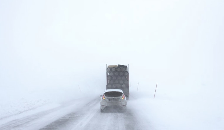
Travel tonight may prove to be especially precarious, with a 90% chance of continuous snowfall, mixed with sleet at times, and the possibility of heavy snow. The added element of strong east northeast winds at 11 to 17 mph, with gusts as high as 32 mph, may result in 3 to 7 inches of new snow and sleet accumulation, as per the NWS advisory. "The strong winds and weight of snow on tree limbs may down power lines and could cause sporadic power outages," stated the NWS's winter storm warning. It went on to note that the hazardous conditions might significantly affect both the Monday morning and evening commutes.
Looking forward to Monday's forecast, the likelihood of snow persists before 1pm, along with areas of blowing snow. Despite the chaotic elements, the day is expected to see a high near 27°F with a north wind of 13 to 15 mph, gusting to a bracing 29 mph. This ongoing event has led the NWS to maintain a 60% chance of precipitation, with new snow accumulation of less than one inch possible. The storm's impact could linger into Monday with additional accumulations of 1-2 inches possible, as mentioned in the NWS's hazardous weather outlook.
As the storm progresses, the NWS recommends delaying all travel if possible. However, if travel is absolutely necessary, they urge drivers to proceed with extreme caution, highlighting the importance of being prepared for sudden changes in visibility. Advising the use of extra caution, the NWS states, "Make sure your car is winterized and in good working order." Motorists are encouraged to carry an emergency kit equipped with an extra flashlight, food, and water. The latest road conditions can be obtained by calling 5 1 1, which may help those having to venture out during the storm. Subzero wind chills are likely to follow by the middle of the week, adding to the adverse weather conditions.


