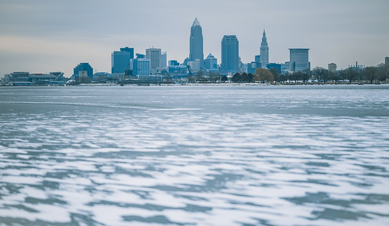
Cleveland is bracing for extremely harsh winter conditions as another arctic blast is set to pummel the region. According to the National Weather Service in Cleveland, a reinforcing cold front crossed the area, leading to temperatures plummeting to the 6 to 12 F range. With southwest winds hitting 10-15 knots and gusts reaching up to 20-25 knots, wind chills dropped into the brutal -10 to -20 F range. A Cold Weather Advisory remained in effect through the evening.
The National Weather Service anticipates that the mercury will continue to fall, potentially reaching lows of -10 to -15 F in many areas, except slightly warmer in NW Ohio and near the lakeshore. The frigid forecast suggests that several climate sites may see record-low temperatures come Wednesday morning. As a result, authorities have issued an Extreme Cold Warning for the state, effective from 7 PM on Tuesday until 10 AM on Wednesday. The arctic conditions are not just limited to plummeting temperatures but also bring lake-effect snow near the Erie, PA, shoreline and snow showers along the cold front.
Meanwhile, the Lake Erie Marine forecast warns of heavy freezing spray affecting the open waters from Avon Point eastward due to gusty winds. The Heavy Freezing Spray Warning covered the waters until the early hours of Wednesday as winds persisted to gust between 25-30 knots. Ice coverage on western portions of Lake Erie is expected to continue to fluctuate with the higher wind activity. Mariners are urged to exercise caution.
In the aviation sector, light snow developed in northwest Ohio in the morning ahead of the cold front, with snowfall expected to possibly intensify in northeast Ohio by late afternoon and early evening. Air travel could be affected by experiencing brief periods of instrument flight rules (IFR) conditions due to snow. While the snow is set to move east of the region by 00Z, the National Weather Service advises that lake-effect snow showers could bring additional minimum aviation operation visibility range (MVFR), with some IFR possible, near KERI until sunrise Wednesday before dissipating.


.jpg)