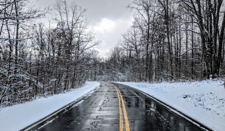
The National Weather Service in Indianapolis has issued a Special Weather Statement, warning residents of slick spots on roads and pathways through Tuesday morning. The NWS alert advises caution for those venturing out, stating, "Untreated roads and walkways will remain slick through Tuesday morning," and urges careful navigation while driving or walking.
Following a nippy start with a 78% humidity count, Indianapolis isn't getting much warmer throughout the day, with expectations for the temperature to rise to a high near 28 and the potential for winds shifting west northwest around 6 mph in the afternoon, tonight's forecast predicts a low around 9, while Wednesday will grace the skies with mostly sunny weather, however, with the high near 21 and west winds gently pushing at 3 to 7 mph, according to the NWS detailed forecast for the area.
As the week progresses, Indianapolitans can anticipate alternating clouds and sun; Thursday offers a brief respite with sunny skies, though the warmth remains elusive, with a high only clawing its way to 21. The serene weather is, however, set to shift by the week's end; Friday is likely to bring snow showers after 1 pm, with a 60% chance of precipitation, turning the lands cloudy and serene roads possibly treacherous as the mercury peaks around 25.
Residents must remain alert as the National Weather Service also predicts wind chill values in the single digits overnight into Thursday morning, bundling up in layers is the recommended strategy against the frigid touch of winter and limiting time outdoors, where exposed skin can feel the bite of the cold, is highly advisable, "Bundle up in layers and avoid prolonged time outdoors, if possible," the Special Weather Statement included.
Into the weekend, the city will continue to experience mostly cloudy conditions with slight chances of snow showers before the weather pattern settles into mostly cloudy days with highs approaching the upper 20s. These fluctuating conditions underscore the importance of remaining prepared for adverse weather, including possible snowfall Sunday night, and the subsequent impact on travel and outdoor activities.


