The latest weather update from the National Weather Service in Sacramento brings a mix of chilly mornings and potential wet weekends to Northern California. According to the forecast by National Weather Service released earlier today, residents can expect "a period of dry weather and cold morning lows" through midweek. However, a more active weather pattern is on the horizon with "widespread rain and mountain snow" likely making a comeback from Friday and into the following week.
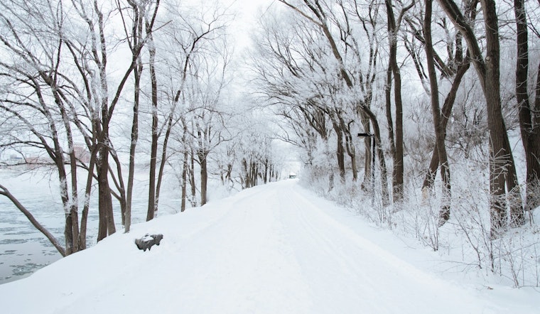
Currently, the Sacramento Valley is experiencing temperatures in the mid to upper 30s, with "areas of frost" being a notable feature of these frosty mornings. A closed low to the south and ridging in the PacNW—detailed at 500mb on weather maps—are influencing this chilly scenario. As the week progresses, these systems will shift eastward, maintaining the cold temperatures with roughly "a 50-70% chance of temperatures reaching 32F or less for the Central and Southern Sacramento Valley and the northern San Joaquin Valley through Thursday morning," as reported by National Weather Service Sacramento CA. Protective measures are recommended for vulnerable populations and sensitive vegetation during this time.
Looking towards the end of the week, changes in atmospheric patterns are set to bring wetter conditions. Precipitation is expected to begin "early Friday morning for the far northwestern parts of our area, then spread east and south into the central Sacramento Valley Friday afternoon/evening." Snow levels are forecasted to start at 5000 feet on Friday, and then rise as warmer air moves in. Initially, the snowfall for higher elevations is projected to be minimal, though these predictions could evolve as new data becomes available, according to National Weather Service.
The extended discussion from the National Weather Service indicates that the weekend will see "upper level troughing moving through NorCal." Despite model discrepancies regarding the positioning and moisture content of the trough, the consensus is that this pattern shift may persist into early next week. Historical precipitation chances are ongoing, with a slight rise in rainfall totals expected, however, "snow totals" are seeing a decrease in predictions. Mountainous regions should prepare for travel disruptions due to "slick and snow covered roads" being a primary concern, according to National Weather Service. Residents should stay updated as forecasts will likely be refined with increased confidence in the expected weather systems' trajectories and intensities.
For aviation interests, "VFR conditions are expected across interior NorCal next 24 hours," and surface winds are predicted to remain relatively calm, with some northeasterly gusts in higher terrain. The National Weather Service has issued no watches, warnings, or advisories at this time, but staying vigilant and checking for updates is advisable as conditions develop.


