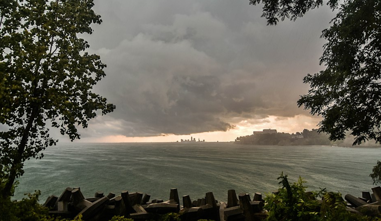
Cleveland's upcoming weather through the weekend features a warm front bringing high temperatures in the 70s, with opportunities for scattered showers and potentially severe storms by Sunday evening. The National Weather Service in Cleveland has forecast a low-pressure system moving northeast from the Central Plains across the Lower Great Lakes on Sunday, followed by a cold front passing through the area on Monday. According to the NWS' Area Forecast Discussion, "High pressure will return by Tuesday," setting the stage for drier conditions after the storms.
Regarding the severe weather outlook, the Storm Prediction Center has placed the forecast area in a Day 2 Slight Risk, meaning there is an enhanced potential for severe weather, which could include heavy rain, strong winds, hail, and a possibility of tornadoes. Wrapped up in the warm sector today through Sunday, the region will benefit from the stalled frontal boundary lying to the north. Moisture and warmth from the southeastern U.S. will continue to flow into the area, culminating in a mix of sun and clouds over the weekend.
As the low intensifies, the weather will shift. The NWS Cleveland states, "A weak mid-level disturbance will bring a round of rain showers across the area late tonight into Sunday morning." This disturbance is expected to provide only a brief respite before the potential for severe weather later Sunday evening. However, some uncertainty remains based on day-time cloud cover and storm development to the west, indicating less severe weather if these factors do not align favorably.
Looking ahead to next week, the weather forecast remains active, with another system arriving midweek, which could prompt another bout of severe weather and heavy rainfall. "We will continue to keep an eye on the evolution of this system and the threat for strong to severe storms Wednesday afternoon and evening," one report from the National Weather Service Cleveland assessed the upcoming situation. Highs will rebound to the mid-60s on Wednesday but will be on the lower side leading up to that day, influenced by the airmass behind Monday's cold front, which could even result in some lake-enhanced rain or snow showers.
For aviators, the NWS notes, "VFR conditions will continue for the next 24 hours" but warns of potential MVFR conditions moving in after 06z with incoming showers. Marine forecasts caution for a small craft advisory on Lake Erie due to sustained southwest winds. As the weather systems progress, changes in the air and water will be closely monitored and updated by the weather service.


.jpg)