Chicago residents are bracing for another bout of severe weather following last night's storm that left over 50,000 ComEd customers without power and extensive damage from high winds and hail. FOX 32 Chicago reports that wind gusts exceeded 60 mph and hail reached over 2 inches in diameter in several areas. Today's weather anticipation includes a high fire risk due to low humidity, strong winds, and temperatures reaching into the 80s, despite not hitting the record highs of the previous day.
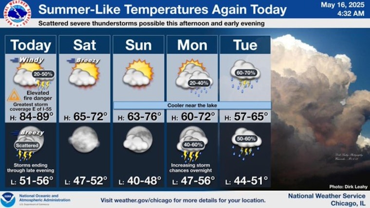
After today, we'll see a bit of a cool down over the weekend along with more tranquil conditions. Periodic shower and thunderstorm chances will return into the middle of next week. (3/3) pic.twitter.com/CMrZFAg3zC
— NWS Chicago (@NWSChicago) May 16, 2025
Evening forecasts suggest a likelihood of storm clusters that could bring further large hail and damaging winds, although the weather is expected to calm significantly after these storms pass. Today's chance of rain sits at 30 percent with potential showers and thunderstorms mainly after 5 pm, as described by the National Weather Service.
Looking ahead to the weekend, clouds are expected to break during Saturday afternoon, making way for sunnier skies with temperatures in the upper 60s, as per FOX 32 Chicago. Sunday promises clearer conditions with a slight cool-down, while early next week holds another possibility for rain showers.


