The San Francisco Bay Area is under a Coastal Flood Advisory, effective from 9 PM Wednesday to 2 AM Thursday. Residents in the Bayshore locations along the San Francisco Bay and San Pablo Bay are advised to exercise caution and avoid driving around barricades or through waters of unknown depth. The advisory comes as the latest in a series of warnings that have locals on alert for potential minor flooding along coastal areas, according to the National Weather Service.
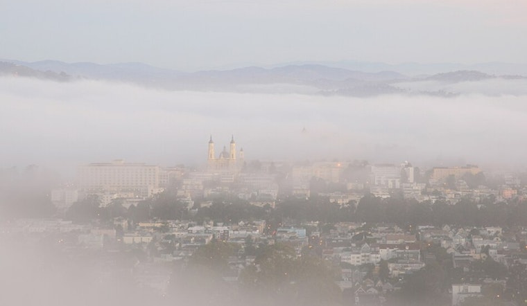
In related weather news, the Bay isn't just preparing for a wetter landscape, but also for its signature fog and cool nights. "Y'all, another night of writing about the stratus. It's here and
it's established leading to a comfortably cool night and pockets of fog," states a report from the National Weather Service. As the marine layer settled in, it brought stratus as far inland as Solano and Yolo counties. The marine layer depth tonight is between 1500-2000ft, likely to clear up later in the morning for most interior locations.
On the brighter side, temperatures across inland areas are expected to range from the low 80s to mid-90s. In contrast, coastal areas and those areas with persistent stratus should see cooler temperatures ranging from the upper 50s to mid-70s. Meanwhile, zonal flow and upper-level troughing beginning Friday indicate that while temperatures may warm up slightly, they will remain within seasonal norms for this time of year.
The forecast isn't all clear skies and calm seas for those planning to take to the skies or head out on the water. Aviation and marine activities are set to navigate through some potentially challenging conditions. Except for Half Moon Bay Airport, the airports are expected to have a mixed bag of LIFR-MVFR with a high confidence in VFR by the afternoon. Conversely, Mariners are warned of fresh to strong northwesterly breezes with near-gale force gusts near coastal jet areas throughout the week. A Small Craft Advisory is in effect for certain areas off the coast.


