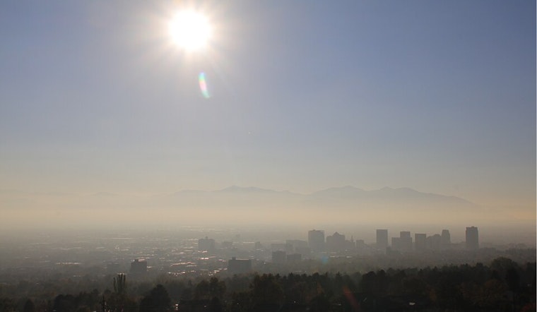
Residents in Salt Lake City can expect to breathe in some smokey air today until around 3 pm, according to the National Weather Service. The city will see clear skies later, though temperatures are set to rise to a high near 97 degrees. Light winds from the east southeast will gently shift to the west northwest in the afternoon, according to the National Weather Service. If you're planning on spending time outside, be prepared for a sunny but potentially smoggy day.
The evening will bring partly cloudy conditions with a comfortable low around 72 degrees. The breeze will maintain its presence, lightly shifting from a northern to southeastern direction post-midnight. Heading into Friday, scattered showers and thunderstorms are expected to make an appearance between noon and 3 pm, later transitioning to isolated thunderstorms. With a thirty percent chance of precipitation, it might be a good idea to keep an umbrella close by.
The full weather report can be found on the National Weather Service website, where the forecast shows a continuing pattern of partly sunny skies and occasional thunderstorms leading into the weekend. Temperatures are expected to slightly dip to a high near 95 degrees on Friday, with southeast winds persisting at a similar speed of around 7 mph, later becoming west southwest in the afternoon. Those hoping for a clear Saturday may be in luck with only a twenty percent chance of showers and thunderstorms after noon.
For the night owls, expect Saturday night to be partly cloudy with a low around 68 degrees. Come Sunday, the skies will clear up completely, offering a sunny start to the week with a high near 94 degrees. This stable pattern of daytime sun followed by slightly cloudy nights is to continue through to Wednesday, giving Salt Lake City several days of predominantly warm and sunny weather, a typical pattern for this time of year.


