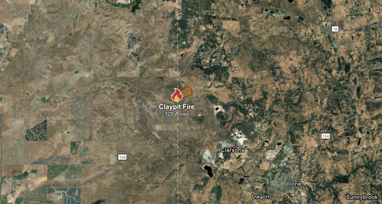
The Claypit Fire that sparked concerns along the Sacramento-Amador county border earlier this week has been brought under control, with firefighters achieving 90% containment of the 128-acre blaze that threatened rural communities near Sloughhouse.
According to CAL FIRE, the fire started on August 4, 2025 at 3:52 PM in the area of Ione Road and Claypit Road in Sacramento County. The flames later crossed into Amador County, with forward progress stopped and crews remaining on scene to monitor hotspots.
Swift Response Prevents Structure Threats
As reported by CBS Sacramento, no structures were threatened and no injuries were reported. The Sacramento Metropolitan Fire District initially responded around 3:53 p.m., reflecting the coordinated response between multiple agencies including the CAL FIRE Amador-El Dorado Unit.
The location near the intersection of Ione Road and Claypit Road puts the fire in a rural area east of Sloughhouse and Wilton, where grassland and oak woodland create conditions conducive to rapid fire spread during California's extended fire season.
Regional Fire Context
The Claypit Fire emerges amid concerning statewide trends that have kept firefighting resources stretched thin across multiple fronts. Spring 2025 was warmer and drier than normal across Northern California, with wildfire activity already trending above normal in both northern and southern regions.
Dead fuel moisture has remained low with live fuels at lower elevations curing quickly, while developing flash drought conditions are pushing fire weather toward critical levels faster than usual. High-elevation forests and lowland grasslands remain of particular concern to fire officials.
Sacramento County's Fire Vulnerability
The location of the Claypit Fire highlights ongoing concerns about wildfire risk in Sacramento County's rural eastern areas. Cal Fire recently released updated fire hazard maps for Sacramento, Amador, and Calaveras counties, revealing moderated zones to help build resilient communities amid rising threats.
These grassland fires, while typically smaller in acreage than their forest counterparts, can spread with alarming speed through the region's dry vegetation. The quick containment of the Claypit Fire demonstrates the effectiveness of rapid response protocols that have been refined through experience with similar incidents throughout the region.
The cause of the fire remains under investigation by CAL FIRE, a standard procedure for all wildland fires to help prevent future incidents and improve response strategies. As California enters deeper into what experts now consider a year-round fire season, incidents like the Claypit Fire serve as reminders for residents in wildland-urban interface areas to maintain defensible space and have evacuation plans ready.


