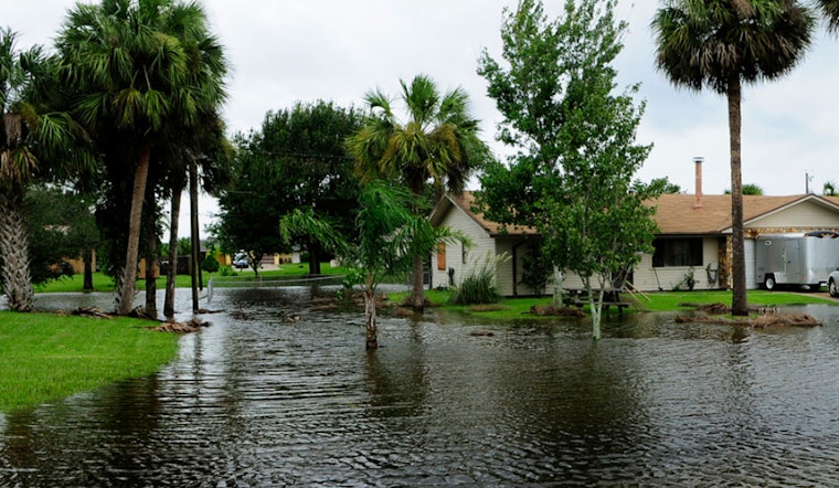
Residents in East Tennessee and Southwest Virginia should prepare for potential flooding as heavy rains are expected to roll in later this afternoon and through the evening hours. The National Weather Service Morristown TN has issued a Hazardous Weather Outlook for the area, highlighting the malaise of an incoming storm that is set to drench the regions of southeast Tennessee and southwest North Carolina, bringing the possibility of localized flooding.
Today, Knoxville is bracing for showers and thunderstorms likely after 2pm, with new rainfall amounts ranging from a tenth to a quarter of an inch—but higher amounts could be unleashed in thunderstorms, especially when calm winds become a southward breeze around 5 mph. With a chance of precipitation standing at a commanding 70%, Knoxville is staring down a barrel, high near 86 degrees Fahrenheit, at another wet episode.
As night falls, the chance of precipitation slightly decreases to 60%, yet the concern for additional showers and thunderstorms rises, particularly before 10pm and between the 10pm to 11pm window. Following the fervor of the evening, a chance of showers and thunderstorms will persist post 11pm. Calm winds are likely to take over after a southwest breezy interlude, maintaining a low-around 72 degrees Fahrenheit with rainfall amounts stacking up to half an inch being possible.
Looking ahead to the rest of the week, tomorrow carries a 60% chance of showers and thunderstorms, with conditions that could heighten flooding concerns. Showers are likely to continue rumbling into the area after 2pm, followed by a probability of a thunderstorm. The familiar calm of the wind and a mostly cloudy sky will preside over temperatures hovering near 86 degrees Fahrenheit.
It's not all gloom though; as the week progresses, we can anticipate some reprieve with a lesser chance of showers and thunderstorms. Thursday anticipates a 40% chance of precipitation during the day and a decrease to 30% by evening, eventually waning to a 20% chance on Friday. The weekend spells out a hot and mostly sunny disposition with a mere 20% chance of rain, taking us back to summer norms in the high 90s. As the sun dominantly stands its ground with temperatures expected to reach near 93 degrees Fahrenheit, remember to keep an eye on the skies for that unpredictable 20% chance of showers and thunderstorms.


