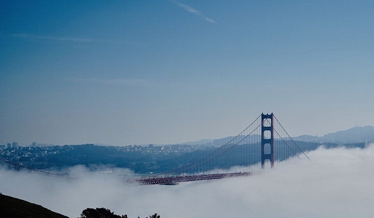
The Bay Area is bracing for a mixture of meteorological phenomena, including dense fog, an ongoing heat wave, and the remnants of a tropical storm, which are converging on Northern California. Morning fog prompted a Dense Fog Advisory along the Pacific Coast and Monterey Bay, set to lift at 10 AM, while regional temperatures persist above normal with widespread Moderate HeatRisk, marking the final stretch of a three-day scorcher, according to the National Weather Service in San Francisco.
The tropical moisture trailing behind SOCAL is a wildcard, transporting the remnants of Mario northward with its sights potentially set on the southern counties by Thursday morning. "Ensemble mean PWATs indicating around 1.40", associated with the leading edge of the remnants of Mario over our southern zones by sunrise Thursday morning, reports the National Weather Service. This moisture content is 200% normal, prompting concerns over near-record PWATs for this time of year in the region.
Thunderstorm activity carries the possibility of strong gusts up to 50 MPH, cloud-to-ground lightning, and heavy downpours. This activity is anticipated to taper into scattered showers extending into Friday as Mario's remnants shift towards Northern California. The weekend forecast suggests a slight reprieve with weak ridging emerging from the desert southwest, though another disturbance could bring rain chances up again starting Monday afternoon.
Aviation is also impacted, with dense fog currently ensnaring terminals such as HAF, MRY, and SNS. "Widespread VFR is expected by this afternoon with clouds lowering through the TAF period as remnant moisture from Post-Tropical Cyclone Mario spreads north," the National Weather Service stated. Coastal waters and interior regions remain on high alert for thunderstorm activity today, with rain showers forecasted to approach Monterey Bay terminals towards the end of their 24-hour TAF period, impacting visibility and potentially causing flight delays.


.jpg)