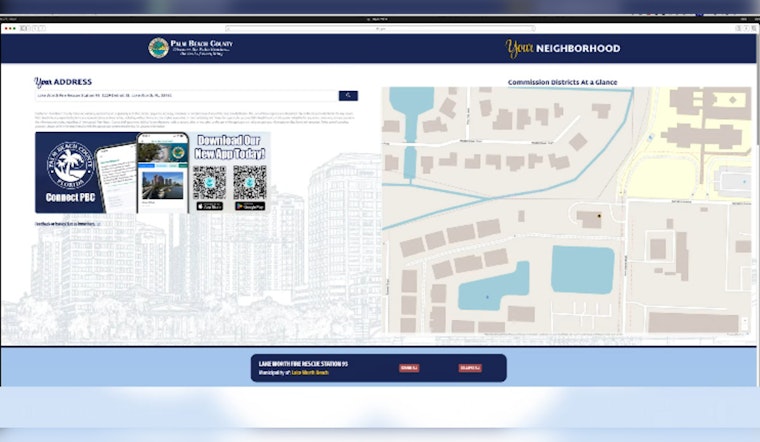
Palm Beach County has rolled out a new digital tool designed to keep residents informed and more deeply connected with their surroundings. The "Your Neighborhood Dashboard" is a comprehensive resource that's just a click away for those seeking details on their local area, from safety zones to schools and beyond, according to the county's announcement.
Residents need only to punch in a valid county address to instantly generate a snapshot tailored to their very neighborhood. This user-centric tool is set to radically improve how folks access and utilize public information. The dashboard doesn't merely list out representatives or emergency routes — it goes as far as to also include data on local schools, zoning, property specifics, and even links to utility providers. This new portal also serves as a gateway to county services, like housing assistance and local parks, and provides a lens into the hustle and bustle of Palm Beach through live traffic and beach cameras. If you're curious about the chambers of commerce or nearby transportation options, they've got you covered there, too.
The tool's integration with county databases promises that the Your Neighborhood Dashboard will always serve up the latest and most accurate information. It's intended to be a pillar of convenience in an often confusing digital landscape, and to absolutely make good on that promise, the county has spared no effort to ensure its information remains as updated as possible.
For those looking to explore the dashboard firsthand, the official Palm Beach County website provides full access. A promotional video is also available for viewers who want a preview before navigating the dashboard themselves.


