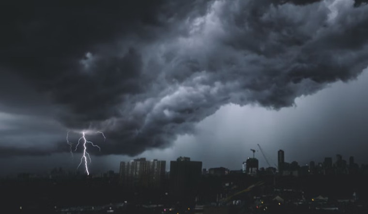
As the summer wanes, Phoenix residents are experiencing a reprieve from the typically scorching temperatures with a forecast that includes showers and possible thunderstorms. According to the National Weather Service, Thursday's weather outlook is partly sunny with a calmer demeanor, a 40 percent chance of rain, and potential thunderstorms looming mainly after 3 pm. As the winds decide, calm in the morning, shifting to southwest around 5 mph in the afternoon, Phoenix will reach a high near 97 degrees. Come nightfall, the chance of precipitation rises to 60 percent, with rainfall amounts expected between a quarter and half an inch.
Transitioning into the weekend, the pattern of afternoon monsoonal activity appears consistent. Friday maintains a 30 percent chance of showers and storms primarily post 5 pm and a high in the low 90s, as per the NWS. The southwest winds, subtle yet resolute, will persist through a mostly cloudy Friday night, where the mercury will dip to around 78 degrees, a scene seemingly orchestrated by the calm of the desert evening.
Into Saturday, a slight decline in storm probabilities to a 20 percent chance offers only a hint of reprieve. It's a partly sunny promise from the sky that temperatures will stage a gradual climb back into the mid-90s. Facing a mostly clear Saturday night with an infinitesimal 10 percent chance of showers before 11 pm, Phoenix will settle into a low around 79 degrees, as reported by the NWS.
The following week ushers in an echo of true Arizona summer, with the forecast signaling a return to sunny skies and climbing temperatures, peaking beyond the century mark by Monday. Evening lows are expected to settle comfortably around 80 degrees, giving residents and visitors alike a consistent pattern as they navigate through the early September days and nights in the Valley of the Sun.


