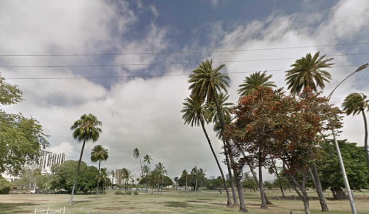
Honolulu residents can expect a continuation of the current light south to southeasterly winds into Friday, with a pattern of overnight land breezes and daytime sea breezes, according to the latest forecast from the National Weather Service (NWS). The western end of the state may experience scattered to numerous showers due to an area of increased moisture that will persist for a few more days. Transitioning into the weekend, light to moderate easterly trade winds are set to make a comeback as high pressure reasserts itself over the state.
In the days to come, a decaying surface low to the north is expected to weaken by Friday, paving the way for those typical easterly trade winds, as detailed by NWS. While the island chain has been experiencing a greater than usual amount of leeward showers recently, the high pressure system is likely to limit those sea and land breezes. The prevalent showers over parts of Kauai, tracing back to a lingering moisture boundary, have even featured occasional lightning, especially northeast of the coast. Radar activities have spiked this morning, indicating more showers on the horizon along the Big Island's coasts.
For aviators, the weak southeastern winds will linger through tonight, bringing with them the familiar sea and land breeze dynamics across the islands. NWS forecasts indicate that VFR conditions will prevail at most Terminal Aerodrome Forecasts (TAF) sites, but pilots should prepare for potential MVFR and even isolated IFR conditions in shower activity. Currently, there are no AIRMETS in effect; however, Kauai may experience mountain obscuration later today due to the moist conditions.
The local marine scene will also feel the effects of the shifting weather, with a surface trough moving northwest of Kauai and Oahu by week's end and a mixed bag of small northwest and north northeast swells maintaining moderate surf through the weekend. Forecasts hint at a swell uptick with easterly trade winds returning, while Tropical Cyclone Priscilla, far off in the East Pacific, could send a medium to long period easterly swell toward the islands by late Saturday. Surfers and mariners should note that buoy readings have been running higher than predicted, signaling that surf heights could crest above expectations.
On the fire weather front, the risk appears relatively low for the near future. Weak winds and sporadic showers should keep the fire danger in check. The NWS points out that inversion heights are currently floating between 5,000 and 9,000 feet, which can influence the spread of particulates and smoke from any fires that might develop.
For those living along the coast, be wary of minor flooding this week. High tides, compounded by the lunar cycle, are expected to creep over coastal areas and especially low-lying zones through early next week, coinciding with peak tides every morning. In response, a Coastal Flood Statement remains in place, and it's likely this advisory will extend into later days.
Honolulu, for now, is in a brief hiatus from weather advisories or warnings, but as the NWS suggests, islanders should stay informed as the evolving atmospheric conditions could herald changes on short notice.


