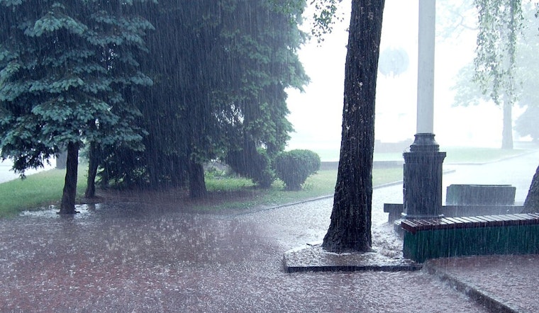
Residents of Atlanta should keep their umbrellas at the ready and prepare for a soggy end to the week, as the National Weather Service forecasts showers beginning this afternoon with a high probability of rainfall throughout the weekend. "Showers likely, mainly after 5pm" today with a balmy high near 72, while winds from the south could reach up to 20 mph, setting a precursory stage for what looks to be a waterlogged few days, as reported by the NWS.
As tonight sets in, the chance of precipitation rises to 80%, with potential thunderstorms developing after 4 a.m. Overnight temperatures are expected to dip to around 62 degrees, a mild low for the season. However, the accompanying storms could produce between three-quarters of an inch and one inch of rainfall, setting the stage for a wet start to the weekend.
The trend continues tomorrow with a 100% chance of showers and possible thunderstorms. Winds will strengthen to 10 to 15 mph, with gusts reaching up to 25 mph, while high temperatures hover near 70 degrees. Additional rainfall of between one-half and three-quarters of an inch is expected, which will likely lead to the familiar urban puddling and slick streets that often accompany heavy rain across the city.
A brief respite from the rain may arrive tomorrow evening as the chance of precipitation drops to 30%, signaling a potential break in the clouds under mostly cloudy skies and a cooler low near 41 degrees. Northwest winds will persist at 10 to 15 mph, with gusts reaching up to 20 mph.
Sunday’s forecast offers a brighter outlook, with mostly sunny skies and a high near 48. However, northwest winds will remain brisk, with gusts as high as 30 mph, giving Atlantans a windy but drier end to the weekend.
As the new week begins, clear skies are expected to be the theme, with Monday and Tuesday bringing mostly sunny conditions and highs ranging from 49 to 55 degrees, along with overnight lows in the low 30s. By Wednesday, clouds will return with a 30% chance of showers.


