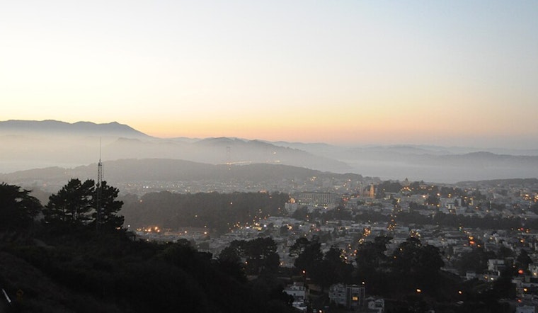
Batten down the hatches, San Francisco – a bit of wind and fog is coming our way. As updated by the National Weather Service, gusty offshore winds are expected to hit the higher terrain in the North Bay and East Bay, lasting through late tonight. These conditions go hand in hand with the usual morning fog that tends to hug our Bay Area valleys. Think of it as a soft, albeit temporary, embrace before it clears by mid-morning, just in time for a Saturday wander.
Notably, while our heads might remain fog-free with the skies clearing, the churning winds above are another story. With morning tranquility on the surface, some residents woke up to the gentlest of breezes, which had allowed the formation of the fog in question. According to the National Weather Service, "The increased offshore flow aloft will introduce drier air through the morning, with some of the surface moisture being chipped away as the column of air mixes." This means that we can look forward to a brighter day ahead with temperatures climbing a full 5 degrees warmer than yesterday, hitting the lower 60s in lower elevations.
Come nighttime, however, the winds are expected to die down, but the clear skies left in their wake mean cooler temperatures as Sunday creeps in. Coastal areas might see temperatures resting comfortably in the 40s and 50s, but inland dwellers should brace for a slight chill. It's the kind of weather that calls for an extra blanket, with overnight lows potentially dipping into the mid-30s in more remote areas.
Looking ahead to next week, variations in the weather forecast could be the bane of our aviation forecasters, with a potential weak storm system on the horizon for mid-week. As for the rest of us, it's suggested light layers and perhaps an umbrella just in case. "Another element to consider will be the return of high clouds Sunday and into the work week, which could complicate overnight cooling and fog development," warns the National Weather Service. Debates still swirl around whether we'll continue to skirt by dry or bear witness to the first droplets from a new system. For now, signs point to the latter, with light rain possible from early Wednesday into Thursday.
For Bay Area pilots, the morning fog might cause initial disruptions, but VFR (visual flight rules) conditions are expected later in the morning and into the afternoon. Monterey Bay terminals will also see any stratus clouds and fog give way to clear skies by 17z (9 a.m. PST). Expect northeasterly winds to whip up to 5 to 10 knots, with the bonus of sea conditions smoothing out into mid next week.


.jpg)