Austin is starting Friday, February 20, 2026, in a gray mood, with low clouds, patchy fog, and temperatures sitting around 65°F before sunrise. A Dense Fog Advisory is in effect for parts of the coastal plains and stretches of the I‑35 corridor through 9 a.m. CST, which could put a drag on the morning commute in a few spots. Forecasters expect clouds to thin around midday, with highs topping out near 68°F before a Pacific front sweeps through late Friday night into Saturday and ushers in much drier air. That shift will crank up gusty north winds on Saturday and set the stage for near‑critical fire weather across large parts of Central Texas into Sunday, so anyone planning outdoor burning or activities that could throw off sparks will want to rethink the weekend game plan.
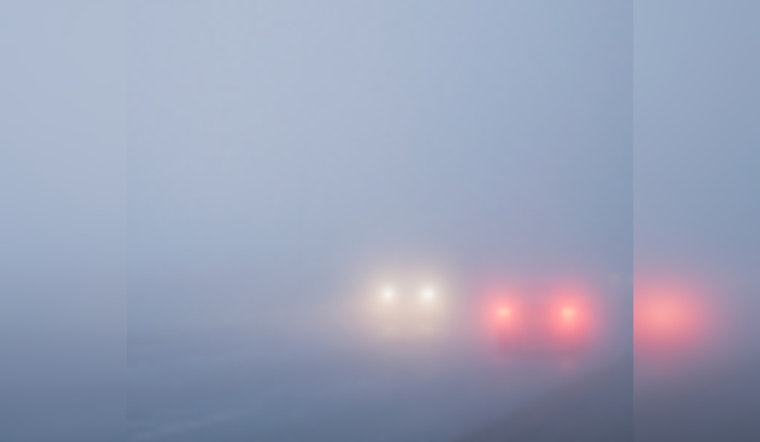
Morning Fog And The Commute
The fog coverage is hit or miss, but where it hits, it hits hard. Low‑lying neighborhoods and areas along the coastal plain could see visibility drop to a quarter mile or less. Drivers are urged to stick with low beams, ease off the gas, and build in extra travel time this morning. If you are catching an early flight, checking airline updates and giving yourself a little cushion for the drive into Austin‑Bergstrom is a smart move. The Dense Fog Advisory remains in place through 9 a.m. CST on Friday, February 20, according to NWS Austin/San Antonio.
Afternoon Into Saturday
Through late morning, skies should stay mostly cloudy before turning partly sunny by afternoon, with a high near 68°F and a light northeast breeze around 5 to 10 mph. Things get more interesting late Friday night when a Pacific front pushes across the region, knocking temperatures down and flipping winds around to the north and northwest on Saturday. Highs on Saturday are expected to reach near 76°F, but those gusts could climb as high as 25 mph. By Saturday night, the cooler air settles in more firmly, with temperatures dropping into the low 40s.
Weekend Fire Weather
Forecasters are calling out near‑critical to possibly critical fire weather for much of South Central Texas on Saturday, with the most concern focused along and east of I‑35 into Sunday. The combination of much drier air and gusty winds will drive humidity lower, which means even small sparks could become a real problem. Outdoor burning and any work or recreation that might create sparks are strongly discouraged while this pattern holds. Residents are urged to honor any local burn bans and follow direction from firefighting and emergency officials. Routine fire‑weather forecasts and spot updates have been adjusted to reflect these elevated concerns, according to NWS Fire Weather.
Looking Ahead
After a cooler stretch Sunday into Monday, temperatures are expected to rebound, with mid‑70s on Tuesday and a sharper warmup into the mid‑80s by Wednesday and Thursday. Anyone planning outdoor events or travel later next week should keep an eye on updated forecasts, since conditions can still shift quickly.


