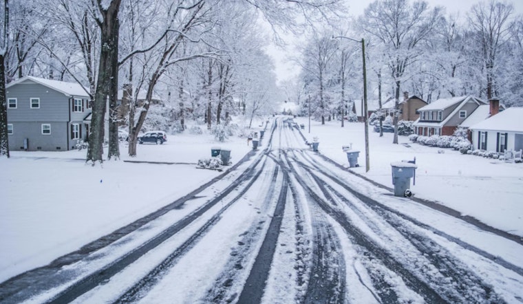
Indianapolis is waking up to a wintry slap in the face this Sunday morning, February 22, 2026, with light snow falling across much of the city and temperatures hovering near 21°F. Visibility drops at times in the passing snow, and roads, especially untreated side streets, bridges and overpasses, may be slick for the morning drive. The chill is sticking around, too, with a forecast high only near 30°F and steady west-northwest winds. Expect scattered snow showers through the afternoon rather than a steady, piling-up snowfall.
Afternoon Winds Crank Up
A strong pressure gradient will kick up west-northwest winds to around 10-15 mph this afternoon, with gusts that could reach roughly 30 mph. That breeze will make it feel even colder and can nudge around loose outdoor items. There is a slight chance of light snow before 10 a.m. Sunday, February 22, 2026, followed by a continued chance of snow showers through the afternoon, though overall precipitation chances remain modest. For the latest details on timing and gusts, check the National Weather Service Indianapolis.
Where a Little Snow Could Stick
Most neighborhoods in Indianapolis are looking at only a dusting at most, but light accumulations are still possible through early Monday, mainly east of a Kokomo–Indianapolis–Greensburg line. Northeast counties could see a few lake-enhanced bands overnight that might create localized slick spots, particularly on elevated surfaces like bridges and ramps. For background on how this chilly weekend setup came together, see Indy Shivers Through Cold Snap.
Midweek Warm-Up and the Next System
A quick rebound is on the way. Temperatures climb Tuesday into Wednesday, with highs near the low 40s on Tuesday and many spots rising into the upper 40s to low 50s by Wednesday. That warmer southerly flow helps set the stage for the next system arriving Wednesday night into Thursday, when rain is more likely at first and a rain-to-snow transition is possible across northern counties, depending on the storm track. Keep an eye on forecasts later in the week, since timing and temperature profiles could still shift.
What to Know for the Commute
If you are heading out this afternoon or for the Monday morning commute, plan on giving yourself a little extra time. Gusty winds will keep conditions feeling raw, and any leftover wet spots can freeze overnight into Monday. Secure lightweight outdoor items that might get tossed around, and take it slow on bridges and overpasses where slick patches tend to form first. Before you hit the road, check the latest forecast from the National Weather Service and any local travel advisories for updates.


