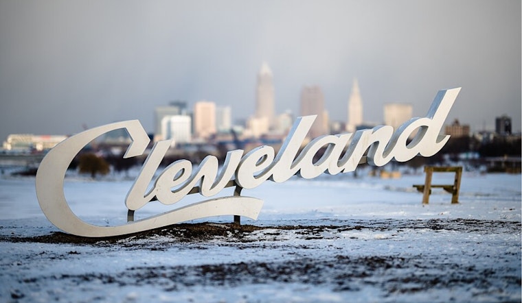
The latest update from the National Weather Service in Cleveland has brought news of minor snow accumulations affecting the region today, with increased chances of precipitation. According to their latest National Weather Service forecast discussion, the probability of snow ("POPs") has been ramped up to 60%. Beyond today's flurries, Clevelanders should brace for additional accumulations of snow expected late Thursday through Friday, although the exact amounts remain a dubious affair to pinpoint at this time.
As temperatures are slated to stay below the norm, hovering around the upper 20s to the lower 30s prior to the frontal sweep on Friday, residents may need to keep their winter gear handy through the weekend. For some context, typically the region expects highs near 35°F and lows around 20°F. But the forecast suggests a chilly divergence from those averages. Overnight lows are projected around the single digits above zero degrees Fahrenheit midweek, and by Saturday and Sunday, the NWS forecast warns of "widespread sub-zero minimum wind chills."
Amid this chilly outlook, Cleveland can expect periodic snow today through Tuesday, with accumulations generally expected to be one inch or less. "Widespread light snow...is expected to traverse our region from west to east today," mentioned the NWS Cleveland report, with a potential for limited lake-effect snow (LES) in the evening. Additional precipitation on Tuesday, albeit light, is anticipated as well due to a passing cold front and another shortwave trough aloft.
The aviation outlook appears a bit murky with anticipated drops in visibility due to light snow showers moving in. The National Weather Service's aviation report indicates that VFR conditions will steadily downgrade, and flight operators should brace for lower ceilings and potentially MVFR to IFR range visibilities. With southerly winds maintaining a modest pace of 5-10 knots, fliers will want to stay updated on potential delays and travel impacts.
Lake Erie mariners aren't left out of the cold, with about 95% of the lake currently under ice. The extensive freeze is set to solidify further as the week's cold persists. The NWS expects southwesterly winds to remain consistent, shifting northwesterly post-Tuesday. Come Thursday evening, however, the lake could see winds ramping up to 15-20 knots in anticipation of a low-pressure system sweeping through, necessitating a keen eye on changing marine conditions.


.jpg)