Memphis and much of the Mid‑South are staring down a volatile round of scattered severe thunderstorms Tuesday, with the most active stretch expected in the afternoon and early evening. Forecasters say the biggest troublemaker will be very large hail, potentially up to baseball size, along with damaging straight‑line winds and a small chance of an isolated tornado. Storms are expected to march from west to east, with the main concern window running from about 1 p.m. to 8 p.m. CDT.
According to the National Weather Service in Memphis, the latest outlook lists large hail as the primary threat, with damaging wind in second place and a tornado that “cannot be ruled out.” NWS Memphis updated its briefing Monday evening, and the shared graphics highlight when and where storms are most likely across the Mid‑South. The City of Memphis Office of Emergency Management (Facebook) post mirrors those same NWS images.
What to expect
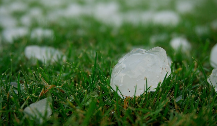
To help people grasp just how big this hail could get, meteorologists like to size it up against everyday sports gear. A golf ball is about 1.75 inches across, a tennis ball comes in around 2.5 inches, and a baseball is roughly 2.75 inches in diameter, which is the upper end that NWS forecasters say is possible in the stronger storms. Ice that size can dent cars, shatter windows, and chew up roofing, especially if multiple storms train over the same neighborhood. Weather.com breaks down how those comparisons help people visualize the risk.
How to prepare
Before storms roll in, move vehicles under cover, tie down or bring in patio furniture, and get pets indoors. If you can hear thunder, head inside a sturdy building and stay away from windows. If a warning is issued, go to a small interior room on the lowest floor. The National Weather Service urges households to keep multiple ways to receive alerts and maintain a basic emergency kit, and the agency’s official National Weather Service guidance offers checklists and sheltering tips to review in advance.
Keep phones charged and keep an eye on local forecasts and alerts from official channels, so you are ready to move quickly if warnings go out. The City of Memphis Office of Emergency Management (Facebook) has already shared the NWS graphics and timing for this event, and residents can follow those pages for real‑time updates. Avoid driving through heavy hail or over downed debris, and report dangerous conditions to local authorities.


