Chicagoans rolled out of bed Friday, March 6, 2026, to find the city swallowed by thick fog, with visibility sharply reduced and a Dense Fog Advisory in effect through 10 a.m. CST. Later today, temperatures are set to jump into the upper 60s, and scattered showers and thunderstorms, some potentially strong, are expected from late morning into tonight.
Fog And The Morning Commute
Visibility has dropped to a quarter mile or less in low-lying neighborhoods and along the lakefront, turning the morning drive into a slow-motion crawl. Bridges and ramps are especially tricky, with sudden changes in visibility catching drivers off guard.
If you have to be on the road, use low-beam headlights, ease off the gas, and leave extra room to stop. The Dense Fog Advisory remains in place until 10 a.m. CST on Friday, March 6, 2026, according to the National Weather Service Chicago.
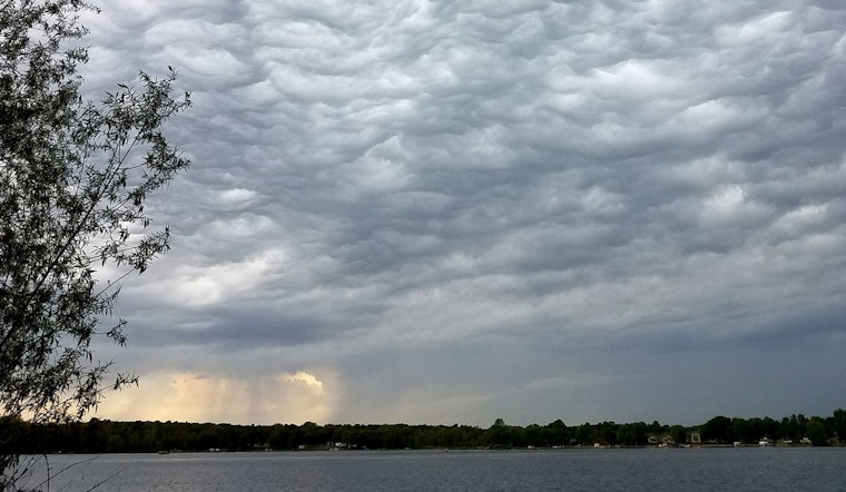
Storms This Afternoon And Tonight
A warm, humid push of air will slide north through the day and spark scattered showers and thunderstorms from late morning into the evening, with another line possible late tonight into early Saturday. Expect pockets of heavy rain and gusty winds, and forecasters say there is a low but real chance that a few storms could turn strong to severe in isolated spots.
For more on how this pattern developed and what it could mean through the weekend, check out the what to expect through the weekend.
Afternoon Winds Pick Up
South-southeast winds will crank up this afternoon, with gusts around 25 to 30 mph possible as the warm front lifts north. A stronger cold front is expected to sweep through late tonight into Saturday, flipping winds to the west-northwest with gusts that could reach 35 to 40 mph in the immediate wake.
It is a good day to secure loose outdoor items and to be extra careful if you are driving a high-profile vehicle. Conditions should trend drier and stay breezy into Sunday, and temperatures are expected to remain above seasonal averages into early next week.
Plan on slower travel this morning and keep a solid indoor backup for any outdoor plans this afternoon or tonight. Treat the fog like a winter commute: lights on, slower speeds, and extra time baked into your schedule. Event organizers should keep a close eye on the sky and be ready to adjust if storms interfere. We will update this post as advisories or conditions change.


