New Orleans rolled out of bed Thursday, March 5, 2026, under a low gray lid of clouds and thick, muggy air. Temperatures hovered around 70°F with southeast winds in the low teens, and the humidity was doing the most. Low clouds stretched across much of the metro, and patchy fog is expected through the morning commute. Highs should push to around 81°F this afternoon, with only a slight chance of spotty showers.
Foggy Start Could Snarl the Morning Drive
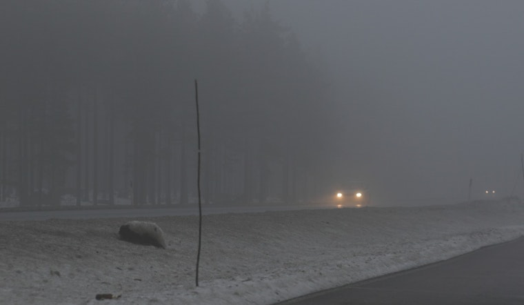
The National Weather Service has issued a Dense Fog Advisory for parts of coastal southeast Louisiana through 10 AM CST, urging drivers to use low-beam headlights and build in extra time, according to NWS New Orleans. Visibility may drop to a quarter mile or less near the Lakefront, along the Mississippi River and on bridges, and mariners can expect restricted visibility in nearshore waters.
If you have to hit the road early, slow it down, skip cruise control and leave more space than usual between you and the car ahead.
Afternoon Warm-Up With Just a Small Shot at Rain
By late morning, some sun should start breaking through, allowing highs to climb to near 81°F before easing back into the upper 70s later this afternoon. The forecast keeps only a slight chance of rain between noon and 5 PM, about a 20 percent shot, so most outdoor plans should be in good shape. Still, tossing a light rain jacket in the bag would not be the worst idea.
This is more of the same muggy-morning, warm-afternoon pattern that showed up in our look at soupy fog and 80s by lunchtime. Tonight, patchy fog is expected to redevelop, with lows near 68°F.
Weekend: More Clouds, More Rain, Watching Storm Potential
Rain chances tick up Friday and through the weekend. Scattered showers and thunderstorms are expected Friday and Saturday, with a better shot at more persistent rain Sunday into Monday. Forecasters are watching upstream severe weather in the ArkLaTex that could slide east late Saturday into Sunday and briefly bump up storm intensity here, according to NWS New Orleans.
For now, the playbook is simple: take it easy in the fog this morning, enjoy the warm afternoons but be ready for a pop-up shower, and check the latest forecast before locking in weekend outdoor plans, especially anything late at night. We will update this post if advisories change or if the severe risk starts to look more likely.


