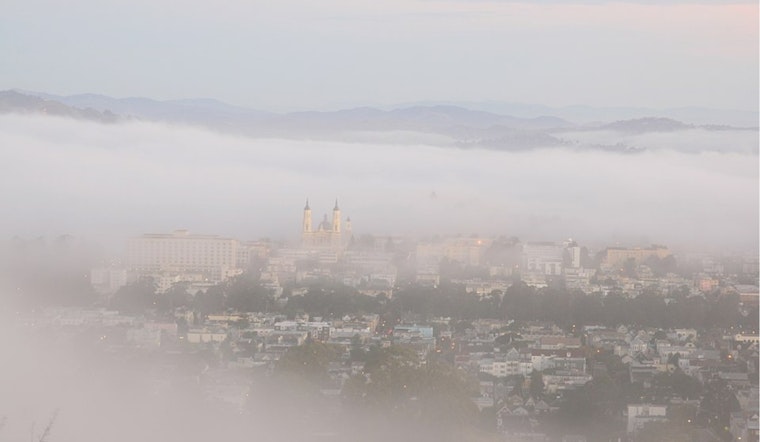
San Francisco started today under a blanket of patchy coastal fog and temperatures in the low 50s, with visibility knocked down along the waterfront. The marine layer is expected to lift by mid-morning, giving way to sunshine and a high near 67°F. Overnight lows will sit in the upper 40s to low 50s, so plan on a cool start paired with a mild, comfortable afternoon.
Afternoon Winds Pick Up
Light west-southwest breezes this morning will shift to a northwest flow by afternoon, with the strongest gusts near the coast and in the coastal hills. Mariners should take note: the National Weather Service has a Gale Warning in place until tomorrow and Small Craft Advisories for parts of Monterey Bay and nearby coastal waters, with very rough seas possible, according to the National Weather Service. It is a good afternoon to skip exposed boat trips and stick closely to local marine advisories.
What To Expect This Week
Tomorrow is on track to be the coolest day of the stretch, with highs near 65°F. After that, temperatures climb, reaching the upper 60s by Wednesday and the low 70s by Thursday and into the weekend. The pattern looks mostly dry and sunny across the city through Sunday, with overnight lows largely holding in the upper 40s to low 50s. In short, expect a brief cool dip before a steady warm-up into the low 70s later in the week.
Commuters And Outdoor Plans
Morning commuters should budget extra time for pockets of dense fog before mid-morning and stick to low-beam headlights in areas with reduced visibility. Afternoon plans will get the reward: sunshine and mild temperatures, though you will want layers for the cooler start and a jacket if you are headed toward the coast, where gusts will be more noticeable. For the latest watches, advisories, and marine conditions, check the National Weather Service.


