This morning, Wednesday, March 4, El Paso woke up to clear skies and about 506 at El Paso International Airport. Under bright sunshine, temperatures are headed for the upper 70s, with highs near 806 across much of the metro by mid to late afternoon.
The calm will not last long. On Thursday, March 5, a fast-moving Pacific trough is expected to flip the script, bringing breezy to gusty west and west southwest winds between about 11 a.m. and 5 p.m. Forecasters are calling for gusts of 40 to 60 mph in favored locations, along with areas of blowing dust and near critical fire weather. That combo could mean sharply reduced visibility on major roads and a bump in wildfire risk, according to the National Weather Service.
Afternoon Winds Pick Up
Winds stay on the tame side today, but Thursday is a different story. The public forecast points to typical metro winds in the 5 to 18 mph range, with gusts near 25 to 30 mph. Mountain passes and gap areas are in line for those stronger 40 to 60 mph bursts mentioned above.
That is the kind of afternoon when patio furniture becomes a flight risk. Secure lawn chairs, trash bins, trailers and any loose outdoor gear before Thursday’s wind machine gets going. Expect gusty crosswinds on I-10 and other area highways during the late afternoon drive, and high-profile and high-end vehicles should be ready for some white-knuckle stretches.
Dust And Fire Weather
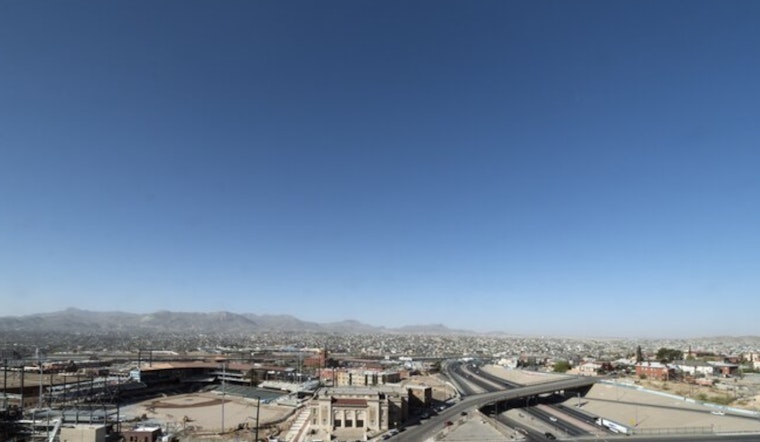
Patchy blowing dust is likely from midday into the afternoon on Thursday, especially along open corridors like I-10, where visibility can drop quickly with little warning.
Local reporting has been hammering home the theme this week: warmer, drier conditions are pushing fire concerns higher across the Borderland. For recent context on the record warmth and increasing fire danger, see coverage from KVIA.
In practical terms, that means avoiding outdoor burning, keeping grills and hot equipment secured, and bringing pets and easily ignited materials inside while it stays dry and gusty.
Weekend Shift
A backdoor cold front slides in Saturday afternoon, March 7, turning winds out of the east and knocking daytime highs down by roughly 10 degrees for the weekend.
There is a slight chance of evening showers Saturday, with better odds for spotty showers and a few thunderstorms Sunday, March 8, and Monday, March 9, before drier weather makes a return.
What You Should Do
To get ahead of the changing weather:
Secure loose outdoor items today, postpone any open air burning, and build in extra travel time if you have to be on the road during Thursday afternoon’s gusty period.
If dust suddenly cuts visibility, pull off the road as far as possible, put your vehicle in park, keep your lights off so others do not follow you, and wait it out until conditions improve.


