As of 5:35 a.m. EDT Sunday, April 5, 2026, Indianapolis was mostly cloudy and about 39°F with a steady west wind. Expect a cool, breezy day with some sun breaking through and highs in the low 50s.
Today will be partly sunny with a high near 53°F, with temperatures slipping into the low 50s during the afternoon. West-northwest winds of 9 to 13 mph and gusts up to about 23 mph will make it feel cooler, so it is a good idea to secure loose outdoor items and take extra care on exposed bridges during the windiest hours.
Afternoon Winds Pick Up
Gusts into the 20s are likely through much of the afternoon and should ease after sunset. That could spell trouble for lightweight yardwork, lawn decorations, and popup canopies, and drivers of high-profile vehicles should stay alert on open stretches of road.
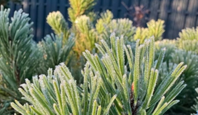
Frost Risk Monday Night Into Tuesday
Monday looks sunnier with a high near 58°F, but skies are expected to clear Monday night and readings are forecast to fall to around 30°F. That is cold enough for frost and a localized freeze in parts of the area. Widespread frost is possible Tuesday morning between about 7 a.m. and 9 a.m., so plan to cover sensitive plants and bring potted plants indoors, according to NWS Indianapolis.
Late-Week Warmup And Spotty Showers
Temperatures rebound by midweek, with highs near 68°F on Wednesday and climbing into the low to mid-70s by Thursday and Friday. A slight chance of rain returns late in the week, with a few showers or a rumble of thunder possible Friday night. It is a shift that was already on the radar in our earlier coverage; see this preview of that weekend washout threat for more on the recent wet system.
Bottom line: grab a light jacket and secure your outdoor gear today, then protect vulnerable plants Monday night into Tuesday morning. Coverage will be updated if any frost advisories are issued.


